Tennessee, Williamson County, Franklin
![]() This Monument memorializes War of 1812 soldiers buried along the Old Natchez Trace, and it honors the service of all brave volunteers who marched on the Natchez Trace during the War of 1812 to help establish American Independence.
This Monument memorializes War of 1812 soldiers buried along the Old Natchez Trace, and it honors the service of all brave volunteers who marched on the Natchez Trace during the War of 1812 to help establish American Independence.
The Natchez Trace served as an important route to move troops for the defense of the Gulf Coast Region. Tennessee Volunteer Cavalry under leadership of Andrew Jackson marched down the Natchez Trace to Natchez in January 1813. Gen. Jackson marched with his soldiers on their return April 1813. Soldier detachments under Jackson's command again marched on the Natchez Trace in 1814, and following the victory at the Battle of New Orleans, most of the Americans who fought the battle returned on the Trace. Volunteers marched hundreds of miles often in severe weather with little food and inadequate equipment. Natchez Trace inns served as hospitals, soldiers who did not survive the marches are buried in unmarked graves along the Trace. On Gen. Jackson's return near this point. He proclaimed his view of the significance of the victory earned by the soldiers sacrifices. "Our rights will henceforth be respected."
(War of 1812) Includes location, directions, 2 photos, GPS coordinates, map.
 This Monument memorializes War of 1812 soldiers buried along the Old Natchez Trace, and it honors the service of all brave volunteers who marched on the Natchez Trace during the War of 1812 to help establish American Independence.
The Natchez Trace served as an important route to move troops for the defense of the Gulf Coast Region. Tennessee Volunteer Cavalry under leadership of Andrew Jackson marched down the Natchez Trace to Natchez in January 1813. Gen. Jackson marched with his soldiers on their return April 1813. Soldier detachments under Jackson's command again marched on the Natchez Trace in 1814, and following the victory at the Battle of New Orleans, most of the Americans who fought the battle returned on the Trace. Volunteers marched hundreds of miles often in severe weather with little food and inadequate equipment. Natchez Trace inns served as hospitals, soldiers who did not survive the marches are buried in unmarked graves along the Trace. On Gen. Jackson's return near this point. He proclaimed his view of the significance of the victory earned by the soldiers sacrifices. "Our rights will henceforth be respected."
(War of 1812) Includes location, directions, 2 photos, GPS coordinates, map.
 BMI (Broadcast Music, Inc.), an organization that collects performance royalties for songwriters and music publishers in all genres of music, opened its doors in New York in 1940. BMI was the first performance rights organization to represent what was then commonly referred to as rural and race music in the forms of country, gospel, blues, and jazz. In 1958, BMI established a permanent Nashville office and hired Frances William Preston as manager. BMI constructed the first wing of this building in 1964 and expanded it in 1995. This office represents songwriters and music publishers in Memphis, Atlanta, New Orleans, Muscle Shoals and Austin, and played a key role in developing Nashville as Music City, U.S.A.
 Born in Johnson County, Tennessee, Charles A. Scott came to Tellico Plains ca. 1890 and was actively involved in its development. During his life, he sold off or donated vast amounts of his 15,000 acre holdings to expand the town. He recruited the Stokely Company and financed local schools. Scott’s progressive experimentation with lime fertilizer, crops and breeds of cattle influenced regional farming techniques. His Neo-Classical Revival mansion was erected from 1908-1912.
 About 1½ mi. E., in the town of Tuskegee, this son of Nathaniel Gist, an emissary to the Cherokee from George Washington, and Wurteh, daughter of a chief, was born about 1770. He designed the alphabet of 85 characters, still in use in the Cherokee Nation; he was also an accomplished silversmith and mechanic.
 The Santa Ana Mountains, which encompass the canyons of Silverado, Modjeska and Trabuco, provided one of the last refuges for the state symbol, the Grizzly Bear.
 Along the south side of the Little Tennessee River for about thirteen miles were ten villages of the Overhill Cherokees. They were Mialaque, Tuskegee, Tomotley, Toquo, Tennessee, Chota, Citico, Halfway Town, Chilhowee, Talassee. White encroachments began upon this site in the 1790’s.
 Born in a house which stood here. Captain in the 5th Tenn. Inf., Mexican War; organizer and first commander of the 3rd Tenn. Inf., CSA, whose first action was the first Battle of Manassas. Promoted brigadier general, he was captured at Vicksburg July 4, 1863; on exchange commanded the cavalry brigade which in 1865 escorted President Jefferson Davis on his flight from Richmond. Speaker of the Tennessee Senate in 1871. He died near Thomasville, Ga., and is buried there.
 The Reverend Edward Weiss, a Washtenaw County circuit rider, organized an Evangelical class of fifteen members in 1874. They met in a school located two miles east of here. Two years later, trustees Herman Gieske, Lambert Gieske and Bernhardt Kuhl, on behalf of the Evangelical Association of North America, bought land from the Rowe family in the area known as Rowes Corners. Church members hauled brick and lumber to the site. Salem Church was dedicated in November 1876. The vernacular Gothic Revival church is similar to others built in the Midwest by nineteenth-century German congregations. Stained-glass windows were installed in the early twentieth century. The denomination merged with the United Brethren Church in 1946 and with the Methodist Church in 1968. That year this church was renamed Sharon United Methodist Church.
 (side 1)
 This plot marks the site of the home of John Cook, pioneer settler, who with his wife Diantha J., and children Freddie W., Mary E., and John W., were murdered by Indians April 26, 1872.
 Built 1845 by John J. French (1799-1889), merchant and tanner who came from Connecticut and New York to Texas in 1830s. Served as home and store, with tannery nearby. Early settlers came to “French Town” to trade tallow, hides, corn, and beef for shoes, harnesses, tanned skins, salt, coffee, tea, cloth, and everyday items. Home remained in French family for 95 years (until 1940). French Road, French schools in area still bear family name. Purchased by Beaumont Junior League, 1968; given to Beaumont Heritage Society. Restored to its 1845 appearance in 1969.
 On July 30, 1955, members of the East and West Chambers County Farm Bureaus and their families held a picnic in Fort Anahuac Park (4 mi. S) which included a variety of youth events and games. The success of the picnic resulted in a sense of unity, fellowship, and goodwill among county residents geographically separated by the Trinity River. Influenced by events such as the Farm Bureau picnic, and aware of the need for unity within the county, leaders of various youth, government, and civic organizations began plans for an annual youth show.
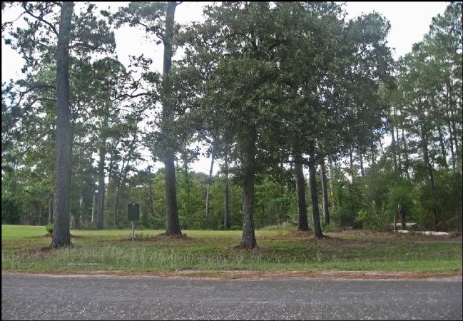 Near site of the signing of
 In the fall of 1803, Captain Meriwether Lewis and William Clark passed this place with about twenty men on their way westward. At the confluence of the Wabash and Ohio Rivers, they first reached territory that is now the State of Illinois. They then turned their boats south on the Ohio toward Fort Massac.
 This was the original site of the home of John Marshall, one of the founders and president of the Bank of Illinois, the first bank chartered by the Illinois Territorial Legislature. The charter was issued in 1816. The bank opened at Shawneetown in 1817, suspended operations in the mid-1820's, and reopened from 1834 to 1842. Marshall was active in business and politics. In 1818 he was elected a legislator from Gallatin County to the first Illinois General Assembly. He died in 1858.
 George Rogers Clark arrived at Fort Massac on June 30, 1778, with about 175 men, under orders from Virginia to capture the British outposts in Illinois. British failure to regarrison the old French fort here enabled Clark to enter the Illinois country without opposition. The British at Kaskaskia expected an attack from the Mississippi River. By marching overland Clark surprised them. He arrived at Kaskaskia on the night of July 4-5, and quickly secured the fort without resistance.
 Erected by Joseph Gray at S.W. corner of present day Bridge and Spring Streets to serve Dutch Flat Wagon Road traffic over Donner Pass.
 Simpsonville Cotton Mill
This mill, opened in 1908, was built after several leading men of Simpsonville asked Edward F. Woodside of the Pelzer Manufacturing Co. to help them establish a textile mill. The Simpsonville Cotton Mill, with Woodside as president and his brother John T. as secretary, opened with 8,000 spindles and 200 looms, making several kinds of cotton cloth. By 1911 it boasted 25,000 spindles and 600 looms.
Simpsonville Cotton Mill
This mill, opened in 1908, was built after several leading men of Simpsonville asked Edward F. Woodside of the Pelzer Manufacturing Co. to help them establish a textile mill. The Simpsonville Cotton Mill, with Woodside as president and his brother John T. as secretary, opened with 8,000 spindles and 200 looms, making several kinds of cotton cloth. By 1911 it boasted 25,000 spindles and 600 looms.
 The Masonic and Odd Fellows Lodges each established cemeteries here in 1869 or 1870 to provide a burial place for their deceased. Catholics established a cemetery to the Southwest. Pioneers and prominent citizens within the original fenced cemetery grounds. The less reputable were buried outside the fences. Stories abound of the bodies placed in snowbanks or ice houses awaiting the ground thaw. The Truckee Cemetery District was formed in 1946 and received title to the land and named the cemetery in 1964. In 1954 the original site increased in size despite the best efforts of the community to prevent the townsfolk from dying.


