Quantcast
Channel: The Historical Marker Database - New Entries
Viewing all 103884 articles
Browse latest View live

South Pass and South Pass City

$
0
0
Wyoming, Fremont County, near South Pass City
A region rich in history. A city rich in gold. From 1812 to 1868 this open country at the end of the Wind River Mountains provided a passage - the only passage - through the Rocky Mountain barrier of the Continental Divide for some 500,000 westering Americans. Through this Great South Pass came the Mountain Men, fur trappers and traders, explorers, missionaries, pioneers in covered wagons traversing the Oregon, California and Mormon trails, overland stage coaches, military expeditions, and Pony Express riders.

In 1866, however, traffic on the great trails had dwindled with the anticipated completion of the transcontinental railroad. Then, in 1867, gold was discovered on Willow Creek. The rush was on. By 1869 more than 30 mines were in operation and some 3,000 people populated the region. The instant towns of South Pass City, Atlantic City and Miners Delight were rip-roaring and wide open for business.

This lusty, male-dominated mining district became the unlikely center of a move for female suffrage when it elected William H. Bright, a South Pass City miner and saloon keeper, to the first Wyoming Territorial Council in Cheyenne. Bright introduced a Female Suffrage Act that gave all adult Wyoming women the right to vote and hold public office. The Act was passed by the legislative body and signed into law on December 10, 1869, making Wyoming the first official government in the country to grant equal rights to women.

The mining boom went bust in the 1870s, and the population moved on to the next bonanza. The towns became near ghosts, although some limited mining activity continued. Today the region is operated as a Historic Mining District by the Bureau of Land Management. South Pass City, two miles south, is a Wyoming State Historic Site.

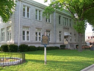
(Civil Rights • Roads & Vehicles • Settlements & Settlers) Includes location, directions, 2 photos, GPS coordinates, map.

Fort Stambaugh, 1870-1878

$
0
0
Wyoming, Fremont County, near Atlantic City
was established to protect from Indians the gold mining camps of South Pass City, Atlantic City, Miners’ Delight, and others. It was named for 1st Lt. Charles B. Stambaugh, 2nd Cavalry, U.S.A. who was shot from his horse by Indians when defending a freighting party, May 4, 1870. Site about 6 miles East.

(Forts, Castles • Wars, US Indian) Includes location, directions, 3 photos, GPS coordinates, map.

McElroy-Severn House

$
0
0
Texas, Hays County, Buda
The complex that includes the McElroy-Severn House/Stagecoach House and Onion Creek Post Office occupies a 51-acre tract of land on a high bluff above a branch leading into Onion Creek, about a quarter mile east of Buda. The post office and stagecoach served the area's residents and people traveling on the Old San Antonio Road beginning in 1875. Once mail service moved to the new railroad town of DuPre (Buda) in 1880, the former station house was converted to a private residence and served as headquarters for a family ranching operations for more than a century.

The McElroy-Severn House (Stagecoach House) is an outstanding example of a late-19th century modified center-passage dwelling. It is a five-bay, side-gabled frame dwelling with a hipped roof porch that stretches across the entire south facade. Features also include limestone chimneys plastered with concrete and interior walls framed with cedar. Several major remodeling campaigns in 1885, 1900 and 1920 have substantially enlarged the house. The adjacent 1876 one-room post office is noteworthy for its fine craftsmanship, solid limestone construction and carved stone lintels. A single door face the rear east wing of the stagecoach house and a small, single-pane window is cut out of its east wall. Other historic resources on site include a brick and limestone well, a concrete trough and concrete walkways and gardens. Together, these buildings recall Buda's beginnings as a collection of isolated homesteads scattered along Onion Creek and reflect a century of Buda's agricultural heritage. Recorded Texas Historic Landmark-2012
Marker is the property of the State of Texas


(Native Americans • Railroads & Streetcars • Roads & Vehicles • Settlements & Settlers) Includes location, directions, 2 photos, GPS coordinates, map.

The Town that Water Built

$
0
0
Arkansas, Carroll County, Eureka Springs

First by horseback, wagons or on foot, invalids from all over this region flocked to Eureka Springs in 1879 to seek cures from the miraculous healing springs. But soon there were easier ways to arrive - stagecoaches, then trains. This laid a base for an early "industrial park."

Bringing railroad service through the rugged mountains and across the White River was no easy feat. A passage was blasted out of a cliff near Beaver, north of town, a high trestle bridge erected over the river, track laid over smaller creeks and rail bed cut out of bluffs along Leatherwood Creek. The cost was $200,000, very expensive in 1882!

"The invalid or tourist who has traveled from the East or North, can leave St. Louis at night and arrive at the Springs the next day... The Kansas City, Springfield & Memphis Railroad run Pullman Parlor Sleeping Cars and chair cars the entire length of their line. All trains reach the city in daylight, and at the depot transfer omnibuses and carriages are in waiting to convey visitors to any hotel or private residence in the city." W.W. Johnston, M.D., The Eureka Springs Arkansas, 1885

The first Eureka Springs Railway Depot was built in 1882. It was used until 1914 when the current limestone depot was constructed. As part of the extensive Frisco Line, Eureka Springs was finally connected to the rest of the country!

Built in 1891 as the city's electric power supply, the Power House had huge coal-fired boilers to run the generators. An ice factory was added later. By 1908 it produced 4 tons of ice daily with 6400 sq. ft. of cold storage.

Almost as soon as the town began, Eureka Springs bottled and shipped water from the famous springs. The most enduring company was the Eureka Springs Water Company with their trade name Ozarka. As early as 1904, four train tanks of Ozarka Water from nearby springs were shipped out each week. Rail shipping continued until the 1950s. At one time the Ozarka Water plant used all these large buildings.

In the Neighborhood

The Round House: Built as the early gas works using limestone quarried north of town.

North Main Arts District: A number of studios, galleries and restaurants make North Main Street a pleasant stroll combining art with the natural beauty of the hills and bluffs rising over both sides.

Eureka Springs & North Arkansas Railway: A scenic, short-line passenger train offers a trip on part of the original route. Visit the second depot, built in 1913, and the train yards.

Landmarks [Map and Key]

This material is based upon work assisted by a grant from the U.S. Department of the Interior, National Park Service, a Preserve America grant. Any opinions, findings, and conclusions or recommendations expressed in this material are those of the author and do not necessarily reflect the views of the Department of the Interior. Photographs courtesy of the Cornerstone Bank of Eureka Springs, Eureka Springs Historical Museum and the Eureka Springs Carnegie Public Library.

(Environment • Industry & Commerce • Railroads & Streetcars • Settlements & Settlers) Includes location, directions, 7 photos, GPS coordinates, map.

Butterfield Overland Mail in Missouri - 1858-1861

$
0
0
Missouri, Barry County, Cassville

Cassville, the last town
on the route of
the Butterfield Mail in Missouri,
was not a relay station
but the coaches stopped
for mail and passengers

(Communications • Roads & Vehicles) Includes location, directions, 2 photos, GPS coordinates, map.

Jackson County Veterans Park

$
0
0
Wisconsin, Jackson County, Black River Falls
Development Committee
Officers as of 1-01-06
Chair person: Daniel E. Getchell • 1st Vice: Rodger "Red" Staffon • 2nd Vice: Dale Cummings • Finance Officer: Merlin Anderson • Adjutant: Gavin J. Johnson • Trustees: David Hale, Don Wagner & Francis Michels • Public Relations: Daniel E. Getchell • Building & Ground Maintenance: Gavin J. Johnson • Ground Maint. Crew: Don Wagner, Francis Michels & Dan Getchell • Brick Marker Chair Person: Marie Dolesy • Assistant Brick Marker Chair: Rosemary Johnson • Deceased committee members: Gerald Vatne and Robert Olsher

The idea of a Jackson County Veterans Park was first presented by Robert Teeples in 1985. In 1993 Jackson County set aside 2 acres for park development. In 1995 three feet of sand was hauled in and leveled by the 229th Engrs. WIARNG. Then the project laid idle for 5 yrs. In Jan. 2000 the officers listed above took over this project. With much support from residents & businesses of Jackson County, Guard units (107th Sparta and 1158th BRF), veterans organizations, (American Legion, AMVETS, Disabled American Veterans, Forty and Eight, Veterans of Foreign Wars and their Auxiliaries) the park took shape. On the various brass plates pertaining to certain projects there are lists of the contributors. If we missed anyones name we apologize, it was not intentional. The Jackson County Veterans Park Development Committee, Inc. says Thanks!

(Military) Includes location, directions, 17 photos, GPS coordinates, map.

The Carissa Mine: Cycle of Boom and Bust

$
0
0
Wyoming, Fremont County, near South Pass City
Thousands rushed to the South Pass area following the find of substantial gold deposits at the Carissa Mine in 1867. As the boom gained steam, the Carissa sat at the center of mining development, serving as the primary economic force for South Pass City. Eventually, the gold played out and the Carissa’s mining technology reached its limit. As a result, the Carissa closed, contributing to the gold bust and the decline of South Pass City in the 1870s.

Modern advances in mining technology and an influx of new money made it possible for the Carissa to reopen in the early 1900s, bringing with it a renewed boom. A large project that modernized the Carissa during the winter of 1928-1929 created additional facilities that were both newly built and moved to the site. The Carissa continued to open and close with new owners, new money, fluctuating gold prices, and new technologies. It closed for the last time in 1949 and the State of Wyoming acquired it in 2003 designating it as a historic site.

(Industry & Commerce) Includes location, directions, 8 photos, GPS coordinates, map.

South Pass City

$
0
0
Wyoming, Fremont County, South Pass City
Founded 1868
A Great Gold Camp
Part of Wyoming’s historical heritage. Acquired for preservation May 18, 1966, with funds raised by Wyoming;s 75th Anniversary Commission Inc., its advisers, county committees and people of Wyoming. Clifford P. Hansen - Governor
Alice Mesick - Chairman
Stephen Accola - Secretary
Kerm Kath - Treasurer
Edness Kimball Wilkins • Lewis Bath
James K. Harrower • Earl A. Madsen


(Settlements & Settlers) Includes location, directions, 15 photos, GPS coordinates, map.

South Pass City: Wyoming’s Biggest Gold Boom and Bust

$
0
0
Wyoming, Fremont County, near South Pass City
Emigrant travelers on their way west likely discovered small amounts of gold in the 1840’s, but it took until 1868 for the first mining claims to be staked. Word of the new gold rush spread and the summer of 1868 brought an influx of people from every corner of the globe to partake in the bonanza. A torrent of mining activity followed for the next several years. In 1869 South Pass City, with perhaps 3,000 people, was Wyoming Territory’s second largest town.

Every boom ends, and by the early 1870’s, the local mining district collectively known as the Sweetwater mines, had passed their zenith. A small handful of hardy hangers-on remained in South Pass City through the years. Later booms, fueled by outside investment capital, kept the embers of civilized living and a connection with the larger world aglow. Today, South Pass City is among Wyoming’s smallest continuously inhabited towns and is also home to its largest State Historic Site.

(Settlements & Settlers) Includes location, directions, 6 photos, GPS coordinates, map.

Lander Cut-Off on the Oregon Trail

$
0
0
Wyoming, Fremont County, near South Pass City
In 1858, this ancient path, which had been used by Indians, explorers and mountain men as a short cut to the Snake River country was developed by Frederick Lander in to an alternate route on the Oregon Trail. What is commonly called the Lander Trail or Lander Cut-Off starts 9 miles to the southeast at Burnt Ranch (directly behind this sign), crosses the Sweetwater River 6 miles to the northwest, and continued along Lander Creek for 13 miles to the Continental Divide at Little Sandy Creek, the headwaters of the Pacific Ocean. From there it travels west across the Green River Valley, the Wyoming Range, and the Salt River Range before entering present-day Idaho. The Cut-Off rejoins the original Oregon Trail near Fort Hall.

This wagon road was favored by travelers for many reasons. The cut-off save as much as 7 days travel compared to the old route though Fort Bridger. avoided the expensive ferries across the Green River to the south, and bypassed the 50-mile waterless desert of the Sublette Cut-Off. Its longest waterless section was only 10 miles, and it had access to abundant grass and firewood. The Lander Cut-Off was used by an estimated 13,000 emigrants its first year, with 9,000 of them signing statements of support for the road at Fort Hall. While use dwindled after completion of the trans-continental railroad in 1869, the trail was still used by emigrants into the 20th century and played a role in the settlement of the Upper Green River Valley.

(Roads & Vehicles • Settlements & Settlers) Includes location, directions, 2 photos, GPS coordinates, map.

Threaded Together with Iron and Steel

$
0
0
Prince Edward Island, Queens County, Charlottetown
English:
The Prince Edward Island Railway brought Islanders together, put them to work, and even made them Canadians.
Before the Railway was built on Prince Edward Island you could live within ten miles of another village and hardly know it existed. All that changed in 1871 when branch lines crossed the Island, dotting the landscape with train stops every few miles of track. Uniting one end of the Island with the other, the Railway connected people in ways they had never been before. The train moved mourners to funerals, brides to weddings, and brass bands to picnics. It carried hockey teams and their fans to matches, transported farmers and their produce to market, and sent children away to boarding school. Whatever the weather, Islanders moved and mingled with the whistle of the train.

French:
Le chemin de fer de l’Île-du-Prince-Édouard a rassemblé les Prince-Édouardiens, les a fait travailler, et en a même fait des Canadiens.
Avant la construction du chemin de fer à l’Île-du-Prince-Édouard, on pouvait vivre à dix milles d’un autre village et à peine savoir qu’il existait. Tous cela a changé en 1871 lorsque des lignes d’embranchement ont sillonné l’île jetant ici là de petites gares à intervalles réguliers le long de ces lignes. Créant un pont entre les deux extrémités de l’île, le chemin de fer a rapproche les gens comme jamais auparavant. Le train transportait les parents et amis du défunt aux funérailles, les mariées à leur ceremonies et les fanfares aux pique-niques. Il transportait les équipes de hockey et leurs partisans à leurs matches, les agriculteurs et leurs récoltes au marché et les enfants au pensionnat. Peu importe le temps qu’il faisait, les Prince-Édouardiens se déplaçaient et se rencontraient au son du sifflet du train.

(Railroads & Streetcars) Includes location, directions, 3 photos, GPS coordinates, map.

The Hillsborough River

$
0
0
Prince Edward Island, Queens County, Charlottetown
English:
The Hillsborough River watershed, totaling over 350 square kilometres, is the largest river system in Prince Edward Island. As a river highway, it provides a direct link to our rich human heritage, from the Mi’Kmaq who depended on the river for food and travel, to the 1864 meeting of the Fathers of Confederation, to the fishers of today and tomorrow. The Hillsborough also harbours the largest saltwater and freshwater marshlands on Prince Edward Island, providing for a diverse natural heritage. This plaque recognizes the special heritage of the Hillsborough and the commitment of the Hillsborough River Association and local citizens to its preservation. As a Canadian Heritage River, management of the Hillsborough will give national recognition and protection to this important waterway.

French:
D’une superficie de plus de 350 kilomètres carrés, le bassin hydrographique de la rivière Hillsborough est le plus important de l’Île-du-Prince-Édouard. Cette rivière navigable assure un lien direct entre diverses composantes de notre riche patrimoine humain: des Mi’Kmaq qui en dépendaient pour leur nourriture et leurs déplacements, jusqu’aux pêchers d’aujourd’hui et de demain qui y recherchent leur subsistance, en passant par les Pères de la Confédération qui se sont réunis sur ses rives en 1864. En outre, la rivière Hillsborough recèle les plus vastes marais d’eau salée et d’eau douce de I’Île, lesquels abritent un patrimoine naturel des plus diversifiés. Cette plaque reconnaît le patrimoine exceptionnel de la rivière et l’engagement de ses riverains et de la Hillsborough River Association à en préserver le caractère. Sa désignation comme rivière du patrimoine canadien lui assure un reconnaissance nationale et la protection qu’elle mérite à titre de rivière importante du Canada.

Mi’kmaq:
To read the Mi’kmaq text, click on the marker image to enlarge the photo.


(Waterways & Vessels) Includes location, directions, 2 photos, GPS coordinates, map.

Survey of the Gulf and River St. Lawrence

$
0
0
Prince Edward Island, Queens County, Charlottetown
English:
Between 1827 and 1856 the first complete hydrographic survey of the Gulf and River St. Lawrence was carried out by Captain Henry W. Bayfield and his assistants. From the time of Cartier, French and British navigators ad surveyed these waters and produced charts, but by the 1820s these waters and produced charts, but by the 1820s these had become inadequate to the changing needs of shipping. The charts and sailing directions produced from Bayfield's work were the authority for the area until the 20th century. His relentless pursuit of accuracy set the standard for the Canadian Hydrographic Service, founded in 1883.

French:
Entre 1827 et 1856, le capitaine Henry W. Bayfield et ses adjoints effectuèrent le premier levé hydrolique complet du golfe et du fleuve Saint-Laurent. Depuis l'époque de Cartier, navigateurs français et anglais avaient cartographié ces eaux, mais leurs travaux ne répondaient plus aux besoins de la navigation des années 1820. Les cartes de la région et les instructions nautiques produites à l'aide des travaux de Bayfield firent autorité jusqu'au XXe siècle, et le souci constant d'exactitude caractérisant toute son œuvre jeta les fondations du Service hydrographique du Canada, créé en 1883.

(Exploration • Waterways & Vessels) Includes location, directions, 2 photos, GPS coordinates, map.

Heralded Arrival… of the Circus

$
0
0
Prince Edward Island, Queens County, Charlottetown
English:
When a large steamer anchored in Charlottetown Harbour in 1864, few took notice of it or the politicians aboard. Charlottetown was preoccupied with another visitor to its little town: the circus. Drawing huge crowds and filling the city’s few hotels, the circus stole center stage from the visiting delegates - robbing them of a formal welcome, suitable accommodation, and proper publicity.

No vacancy!
That’s what John A. Macdonald and the other delegates from the Province of Canada heard when they arrived in Charlottetown for the historic 1864 Conference. Turned away with every knock, the Canadians were forced to sleep in their quarters aboard the SS Queen Victoria - the very steamer they arrived on!

French:
Lorsqu’un gros vapeur jette l’ancre dans le port de Charlottetown en 1864, bien peu de gens le remarquent ou remarquent les politiciens à son bord. Les habitants de Charlottetown sont alors préoccupés par un autre visiteur arrivé dans leur petite ville: le cirque. Ce dernier attire de grandes foules qui occupent les quelques hôtels de la ville; le cirque vole la vedette aux représentants politiques, sans compter qu’il les prive d’un accueil officiel, d’un hébergement convenable et de la publicité nécessaire.

Complet!
Voilà ce que John A. Macdonald et les autres délégués de la province du Canada ont entendu à leur arrivée à Charlottetown pour la conférence historique de 1864. Ne trouvant pas d’hébergement là où ils s’adressaient, les Canadiens ont été forcés de dormir dans leur quartiers à bord du Queen Victoria, le même vapeur a bord duquel ils étaient arrivés!

(Politics) Includes location, directions, 2 photos, GPS coordinates, map.

Great George Street Historic District

$
0
0
Prince Edward Island, Queens County, Charlottetown
English:
Great George Street is richly evocative of both its 18th-century origins and its subsequent development as one of Charlottetown's principal streets. Clearly focused to Province House, the seat of Island government and the birthplace of Confederation, the street has traditionally been lined with homes and public buildings. In 1864 the Fathers of Confederation attending the Charlottetown Conference landed on the wharf at the bottom of this street, and some delegates stayed in the nearby Pavilion Hotel. Houses influenced by British classicism were the first buildings on Great George Street. Over the years, structures designed in a variety of styles gradually joined and complemented them. The graceful architectural evolution of the street has allowed soaring stone church towers to mingle successfully with simple wooden and brick buildings. A harmony in use, scale and setting among its structures, cohesively meshed with memories of the great events the street has seen, continues to convey a clear sense of its place in our national history.

French:
La rue Great George rappelle abondamment ses origines du XVIIIe siècle et sa transformation subséquente en l'une des principales rue de Charlottetown. Orientée vers Province House, siège du gouvernement de l'Île-du-Prince-Édouard et berceau de la Confédération, elle est depuis toujours bordée d'édifices publics et de maisons particulières. En 1864, les pères de la Confédération, venus assister à la Conférence de Charlottetown, débarquèrent sur le quai situé à son extrémité, et certains délégués séjournèrent à l'hôtel Pavilion, à proximité. Aux premières demeures inspirés du classicisme britannique qui y furent construites vinrent s'ajouter peu à peu des bâtiments de divers styles. Et des églises aux imposants clochers de pierre côtoient avantageusement de simples constructions de bois et de brique. L'harmonie d'usage, d'échelle et de situation de ses bâtiments, alliée à l'empreinte des événements marquants dont elle a été témoin, souligne nettement la place que cette rue occupe dans l'histoire de notre pays.

(Roads & Vehicles • Settlements & Settlers) Includes location, directions, 3 photos, GPS coordinates, map.

Carvell Building

$
0
0
Prince Edward Island, Queens County, Charlottetown
named for the Carvell family who
operated a wholesale business
on this site during the
mid 1800s

(Industry & Commerce) Includes location, directions, 2 photos, GPS coordinates, map.

Miguel Garcia Granados

$
0
0
Guatemala, Guatemala, Guatemala City

Al General
Miguel Garcia Granados
La Patria
1896


English translation:
To General
Miguel Garcia Granados
The Nation
1896

(Notable Persons) Includes location, directions, 7 photos, GPS coordinates, map.

Peake House

$
0
0
Prince Edward Island, Queens County, Charlottetown
named for James Peake,
a prominent shipbuilder and merchant
who lived in this building during the
mid 1800s

(Industry & Commerce) Includes location, directions, 2 photos, GPS coordinates, map.

Sir Louis Henry Davis

$
0
0
Prince Edward Island, Queens County, Charlottetown
Born in Charlottetown, Davies studied law at the Inner Temple and was admitted to the bar in 1867. A member of the Legislative Assembly (1872-9) and Premier for the last three years of that period, he defended the rights of tenant farmers while working towards the resolution of the land tenure question. He was equally effective in serving the interests of his country as counsel to the International Fisheries Commission at Halifax in 1877. Member of the House of Commons (1882-1901) and Minister of Marine and Fisheries in 1896, he was appointed to the Supreme Court in 1901 and became Chief Justice in 1918. He died in Ottawa.

French:
Davies, né à Charlottetown, oeuvra sur la scène politique de sa province à titre de député, procureur général et premier et premier ministre. Défenseur des métayers, il régla la question de la tenure des terres et fit voter la gratuité scolaire. Conseil à la commission internationale sur les pêcheries à Halifax en 1877, il y fit prévaloir les droits de ses nationaux. Député à la Chambre des communes de 1882 à 1901, ministre de la marine et des pêcheries en 1896 il accéda en 1901 à la Cour suprême dont il devint juge en chef en 1918. Il fut appelé au Conseil privé impérial en 1919. Il est décédé à Ottawa.

(Notable Persons) Includes location, directions, 3 photos, GPS coordinates, map.

Dundas Terrace

$
0
0
Prince Edward Island, Queens County, Charlottetown
English:
This apartment building, completed in 1890, is a handsome example of the Queen Anne Revival in Canada. Admired for its picturesque qualities, this style was popular in Canadian domestic architecture from the 1880s to the 1910s. As this charming residence illustrates, the use of varied volumes and rooflines, projecting and receding masses, and textured surfaces creates a lively architectural composition. Named for a nearby waterfront esplanade, Dundas Terrace was designed by the renowned Island architect W. C. Harris, a master of this style.

French:
Cet immeuble d'appartements constitue un bel exemple d'architecture néo- Queen Anne au Canada. Fort apprécié pour ses qualités pittoresques, ce style marqua l'architecture domestique canadienne des années 1880 à 1910. Comme en témoigne ce charmant édifice, le recours à une variété de volumes et de profils de toits, de masses en saillie et en retrait ainsi que de surfaces texturées permet d'animer la composition architecturale. Tirant son nom d'une esplanade voisine, Dundas Terrace fut achevée en 1890 selon les plans de W. C. Harris, architecte réputé de l'île et un maître de ce style.

(Notable Buildings) Includes location, directions, 3 photos, GPS coordinates, map.
Viewing all 103884 articles
Browse latest View live


Latest Images