Wisconsin, Door County, Namur![]() The Town of Williamsonville
The Town of Williamsonville
Tornado Memorial Park in Door County is located on the site of the former settlement of Williamsonville. The town was settled by the Williamson family in 1869 to take advantage of the Door County State Road opened in 1867 that linked Green Bay and Sturgeon Bay.
By 1871, Williamsonville had a steam-powered shingle mill for processing wood from the nearby pine forests and cedar swamps, a boarding house, a blacksmith shop, eight houses, and 10 acres of cleared farmland. The town’s population of 76 included men, women, and children.
The Peshtigo Fire
On October 8, 1871, events conspired to erase Williamsonville from the landscape if not from memory. Contemporary accounts tell us:
“The woods and the heavens were all on fire, the smoke blocked the sun and the rising moon turned red.”
The Peshtigo Fire is less well known than the Chicago Fire that occurred on the same day. The Peshtigo blaze remains the most destructive forest fire in American history. The Peshtigo Fire destroyed one million acres of farms, forests, sawmills, and small towns in Wisconsin and Upper Michigan, including the town of Williamsonville. For ten days prior to October 8, 1871, residents of Williamsonville had been fighting small blazes and had set back-fires to protect their town. Despite these efforts, a strong wind began to blow on the evening of October 8, fanning fires and spreading sparks and eventually burning all of Williamsonville’s buildings. People took shelter in a potato patch south of the town, in the town well, and under wet blankets in beds of ash. Fifty-nine of the town’s 76 residents died as well as 16 horses, five oxen, and 38 hogs. Williamsonville was never rebuilt.
Remembering Williamsonville
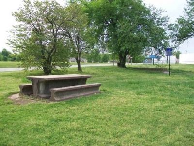
When Tornado Memorial Park was opened in 1927 to commemorate the destruction of Williamsonville, the Sturgeon Bay Advocate reported that the site was in the same condition as it was after being destroyed by fire.
The land included partial foundations of the boarding house, well, and mill, the location of the former potato patch, and many charred tree stumps.
Archeology at Williamsonville
Archaeological investigations uncovered portions of
the mill and several structures, including houses and outbuildings.
Because of the site's significance, Wis
DOT redesigned
WIS 57 to avoid the site and preserve the archaeological deposits.
A List of Those Who Perished in the Fire of October 8, 1871 at Williamsonville, Wisconsin
Published in the Door County Advocate, October 26, 1871.
At Williamson's Mill
Joseph Married, wife and three children •
Nelson Dimrow, wife and two children •
Michael Adams, wife and three children •
John Williamson, wife and one child •
Jos. Marcoix, wife and two children •
James Williamson and wife •
Mrs. Buckland and two children •
Unknown French woman and two children •
Thomas Crane • John O'Conners • Chas. Duncan • Emery Jervis • John Conlan • Unknown Woman • Henry Jervis • Maggie Williamson • Freddy Williamson • Maggie 0'Neil • Patrick Ahearn • Charles Weinbeck • Peter Bordway • Joseph Verbonker • Thomas Whelan • Dan Nickolson • Frank Borway • Jason Williamson • George Buckland • J. Williamson, Sr. • James Whelan • James Donlan • Mike Rogan • John Ahearn • Frank Donlan • Louis Longley • Maggie Heaney • Unknown Woman • Four unknown bodies found in the woods.
At Scofield & Co. Mill
Twelve unknown men
(All photos UWM-ARL 2012)
logos of United States Department of Transportation, University of Wisconsin–Milwaukee, Wisconsin Department of Transportation (Disasters • Roads & Vehicles • Settlements & Settlers) Includes location, directions, 2 photos, GPS coordinates, map.


 The Northwestern Turnpike, a favorite project of George Washington, opened in 1838. Such highways were called "turnpikes" from the gates at which tolls were collected. This town is named for the toll gate which stood here.
 In 1790, the La Rue brothers, Frenchmen, built homes in Pleasants County. Isaac settled on Middle Island Creek. Jacob had a home on Middle Island and a mill on Broad Run. Graves of his family are on Middle Island.
 Side A
 Dedicated to
 Established as a town, 1851, by Alexander H. Creel on land originally granted to Henry Thomas, Revolutionary soldier, in 1785. Creel built the "Cain House", which became one of the most famous of the Ohio River taverns.
 Named for the French town which was made famous by the poet, Petrarch. It was established in 1837 by Alexander H. Creel and was the business center of a large area until St. Marys became the county seat.
 Made famous as line between free and slave states before War Between the States. The survey establishing Maryland-Pennsylvania boundary began, 1763; halted by Indian wars, 1767; continued to southwest corner, 1782; marked, 1784.
 Side A
 Settled by Edward Doolin who was killed here by Indians in 1785. Named for Presley Martin. Here stands a monument to Levi Morgan, a scout for the army of General St. Clair. He was a noted Indian fighter who killed 100.


