North Carolina, Carteret County, Beaufort
![]() Before the outbreak of the Civil War in 1861, local citizens formed the Beaufort Harbor Guards. These Confederate sympathizers, led by Capt. Josiah Pender, occupied Fort Mason when the sole guard, U.S. Army Ordnance Sgt. William Alexander, quietly surrendered.
Before the outbreak of the Civil War in 1861, local citizens formed the Beaufort Harbor Guards. These Confederate sympathizers, led by Capt. Josiah Pender, occupied Fort Mason when the sole guard, U.S. Army Ordnance Sgt. William Alexander, quietly surrendered.
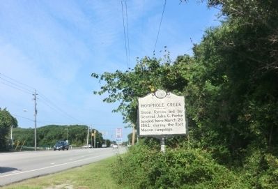
During the siege of Fort Macon (Mar. 23-Apr. 25, 1862), Union signalman on the porch of the Atlantic Hotel directed the Federal artillery in the dunes so that the shells fell accurately on the fort. Afterward, the hotel served U.S. forces as Hammond Hospital until the war ended, then it reopened as the Atlantic Hotel. The Sisters of Mercy, Roman Catholic nuns from New York, cared for the wounded and sick of Beaufort between July 1862 and May 1863.
Josiah Fisher Bell, whose house stands on the grounds of the Beaufort Historic Site, served as a Confederate secret agent and helped coordinate the movement of Southern troops into and out of the area. In April 1864, he planned and executed a mission to destroy the Cape Lookout lighthouse. His group succeeded in destroying one lighthouse and severely damaging the other.
The Old Burying Ground here contains the burial markers of both Confederate and Union soldiers as well as the graves of slaves and free blacks. Broad Street (to the north) became a major center for black refugees, and the area was known as Union City. During the Federal occupation of Beaufort, the deep-water port became an important coaling and repair station for the North Atlantic Blockading Squadron.
(sidebar)
Beaufort, N.C.-Beaufort is an important place in North Carolina, periodically threatened by the rebels, who fret and fume over our possession of their sea coast. Our sketch gives a view of Beaufort, from Morehead city.
Beaufort was, in other days, a port of entry. It is the capital of Carteret county, and stands as the mouth of Newport river, a few miles from the sea. The harbor is considered the best in the state and is defended by Fort Macon, and gallantly taken by our forces.
(captions)
(center) Josiah Fisher Bell
(upper right) Frank Leslie’s Illustrated Newspaper, April 28, 1862. View of Fort Macon and Beaufort Harbor.
(lower right) Below are a few points of interest. A more detailed walking tour brochure is available inside the Historic Site Welcome Center.
(Cemeteries & Burial Sites • War, US Civil • Waterways & Vessels) Includes location, directions, 5 photos, GPS coordinates, map.
 Before the outbreak of the Civil War in 1861, local citizens formed the Beaufort Harbor Guards. These Confederate sympathizers, led by Capt. Josiah Pender, occupied Fort Mason when the sole guard, U.S. Army Ordnance Sgt. William Alexander, quietly surrendered.
During the siege of Fort Macon (Mar. 23-Apr. 25, 1862), Union signalman on the porch of the Atlantic Hotel directed the Federal artillery in the dunes so that the shells fell accurately on the fort. Afterward, the hotel served U.S. forces as Hammond Hospital until the war ended, then it reopened as the Atlantic Hotel. The Sisters of Mercy, Roman Catholic nuns from New York, cared for the wounded and sick of Beaufort between July 1862 and May 1863.
Josiah Fisher Bell, whose house stands on the grounds of the Beaufort Historic Site, served as a Confederate secret agent and helped coordinate the movement of Southern troops into and out of the area. In April 1864, he planned and executed a mission to destroy the Cape Lookout lighthouse. His group succeeded in destroying one lighthouse and severely damaging the other.
The Old Burying Ground here contains the burial markers of both Confederate and Union soldiers as well as the graves of slaves and free blacks. Broad Street (to the north) became a major center for black refugees, and the area was known as Union City. During the Federal occupation of Beaufort, the deep-water port became an important coaling and repair station for the North Atlantic Blockading Squadron.
(sidebar)
Beaufort, N.C.-Beaufort is an important place in North Carolina, periodically threatened by the rebels, who fret and fume over our possession of their sea coast. Our sketch gives a view of Beaufort, from Morehead city.
Beaufort was, in other days, a port of entry. It is the capital of Carteret county, and stands as the mouth of Newport river, a few miles from the sea. The harbor is considered the best in the state and is defended by Fort Macon, and gallantly taken by our forces.
(captions)
(center) Josiah Fisher Bell
(upper right) Frank Leslie’s Illustrated Newspaper, April 28, 1862. View of Fort Macon and Beaufort Harbor.
(lower right) Below are a few points of interest. A more detailed walking tour brochure is available inside the Historic Site Welcome Center.
(Cemeteries & Burial Sites • War, US Civil • Waterways & Vessels) Includes location, directions, 5 photos, GPS coordinates, map.

 The area around Beaufort and Morehead City long has been valued by marine biologists for its research potential. Army surgeons at Fort Macon in the 1870s published articles about marine life. In the 1880s The Johns Hopkins University for six summers used the Gibbs House on Front Street in Beaufort as a seaside laboratory. In 1899 the federal government chose Beaufort as the site for a fisheries laboratory, the nation’s second after Woods Hole, Mass. That lab moved 1-½ miles west to Pivers Island in 1902. Duke University founded its marine laboratory on the island in 1938. The University of North Carolina since 1947 has operated a marine studies facility at Camp Glenn in Morehead City. Rachel Carson (1907-1964), pioneer environmentalist and author of Silent Spring and The Edge of the Sea, conducted research in Beaufort in her later years. The estuarine sanctuary across from the Beaufort waterfront is named in her memory.
 Historic Building
Built in 1883 by Elijah Swift as a private kindergarten, then used as the Hardy School for Young Ladies and Children from 1887-1890.
Historic Building
Built in 1883 by Elijah Swift as a private kindergarten, then used as the Hardy School for Young Ladies and Children from 1887-1890.


 To see the comparison table click on the image to the right to enlarge it
 That empires might fall and that peoples every
 In 1864, Dwight Keep constructed this typical canal era stone structure which began as the Benjamin C. Moore Company Mill. Around 1884, the building was converted from a flour mill to one of the first water pumping plants in America. The Holly Water Works was a pioneer company in the development of central pumping systems. In 1893 the building became Lockport City Hall and remained so until the city offices moved to the new Municipal Building in 1974.
 Originally built in 1826 for visionary businessman Lyman A. Spalding, the smaller three-story stone building built on this site became the Norman & Evans Iron Foundry. After the building burned in 1840, it was rebuilt several times and enlarged to an impressive seven story “Electric Building" by Charles E. Dickinson, making it one of the tallest buildings in Lockport at the time. A hydraulic race from the Canal passed through the seventh story of this towering old stone building. The Electric Building was one of America’s most unique industrial structures, with features designed by Birdsill Holly and his friend/fellow inventor Thomas A. Edison, and was a tribute to their ingenuity. The water power derived from the hydraulic raceway on the south side of the canal at the Niagara Escarpment powered all of Lockport’s street lights (free of charge to the citizens of Lockport at the time). You are now standing on what was the sixth story of the Electric Building.
 When the Barge Canal opened on May 15, 1918, a large steam tug was chartered by the government to tow state boats on the new canal. The wages were based on a monthly scale for a twelve-hour workday and included board. The Captain received $175 per month, Mat $150, First Engineer $150, and Second Engineer $120. The two firemen and the cook each received $90 per month. The tug operated night and day, and all the crew, except the cook, worked six hours on and six hours off duty. Their employer allowed 90 cents per day to feed the crew.
 The Lockport Federal Building is architecturally significant as an outstanding example of early twentieth century public architecture. Built between 1902 and 1904 from a design by James Knox Taylor, supervising architect of the Treasury Department, this three floor structure is listed in the National Register of Historic Places. Generations of Lockportians remember this structure as the Post Office and for the stately courtroom located on the second floor. Restoration begun in 1992 returned the building to its original grandeur under owners Michael and Patricia George.
 The W.H. Upson Coal Company was founded in 1877. In 1902 Charles A. Upson built this stone building for his father, William Henry Upson, as the company’s offices. In 1910 the building weighing 440 tons, was moved westward 32 feet to make room for the expanded new Big Bridge. This building also served for a period as passenger and freight office for the Erie Railroad. The W.H. Upson Coal Company sold the building in 1952. In 1985 W.H. Upson’s great grandson Henry W. Schmidt purchased the building and renovated it for his law practice.
 Near this site
 Editor and publisher the Vermont Gazette
 Erected in honor of Brigadier General John Stark and the 1400 New Hampshire men who came to the defense of Vermont in August 1777. Assembling at Fort Number Four in Charleston, New Hampshire, Stark and his troops crossed the Green Mountains to aid in the defense of the newly-established State of Vermont. As the commander in chief of all the American forces from New Hampshire, Vermont, Massachusetts and New York, General Stark had approximately 2000 men in all in the first phase of the battle. General Stark’s army defeated and captured a British detachment lead by Col. Fredrich Baum. Shortly after this triumph, with the assistance of Col. Seth Warner and his “Green Mountain Boys,” a relief column under Col. Heinrich Von Breymann was repulsed. By thus denying the enemy sorely needed supplies these twin victories near Bennington on August 16, 1777, contributed notably to the total British surrender at Saratoga two months later, and to the subsequent military alliance with France, the turning point in the war for American Independence
 The Warner monument has text on the four sides of the base


