Sonora, Texas.
![]() F. Mayer & Sons purchased the T-Half Circle Ranch in Sutton and Schleicher counties in 1896. Sol, who became sole owner, was a livestock trader, rancher, banker and philanthropist. The ranch has been continuously operated by . . .
F. Mayer & Sons purchased the T-Half Circle Ranch in Sutton and Schleicher counties in 1896. Sol, who became sole owner, was a livestock trader, rancher, banker and philanthropist. The ranch has been continuously operated by . . .
(Settlements & Settlers) Includes complete text, location, directions, 1 photo, GPS coordinates, map.
 F. Mayer & Sons purchased the T-Half Circle Ranch in Sutton and Schleicher counties in 1896. Sol, who became sole owner, was a livestock trader, rancher, banker and philanthropist. The ranch has been continuously operated by . . .
 (Settlements & Settlers) Includes complete text, location, directions, 1 photo, GPS coordinates, map.
 Property of Special Merit Awarded by The Bloomsburg Historic Preservation Society
 {Title is text}
 This property contributes to the Bloomsburg Historic District Placed on the National Register of Historic Places 1983
 This property contributes to the Bloomsburg Historic District Placed on the National Register of Historic Places 1983
 This is a portion of the ridge where the Confederates faced the occupying Union Forces and General W. T. Sherman in the Battle of Collierville. When you look north toward the railroad and the town square you are standing in . . .
  CS - US
 A pioneer who came to this area in the late 1880's. He raised cattle, sheep and horses on land in Sutton and Edwards counties. Out of this land he made available six sections which became the Sonora Experiment Station. He . . .
  English Text: This monumental synagogue occupied the southeast corner of the Roman bath-gymnasium and served as the center of a prosperous Jewish community during late antiquity. Discovered in 1962, the building is the . . .
  The Steam Railroading Institute is a museum dedicated to educating the public about steam-era railroad technology. This museum is the home of the locomotive used to create the images and sound for the movie " The Polar . . .
  English Text: Apse and Benches The curved wall of the apse was once pierced by three niches and two vaulted passageways. The openings were later blocked and the wall covered with bands of white and colored marble. Three . . .
  Lighthouse of Highway 95 In 1946, Jim and Velma Summerville built a liquor bar, cafe, and supperclub. Summerville’s Cafe and Club was known as “The Lighthouse of Highway 95,” welcoming countless travelers to their 24-hour . . .
  As the City of South Haven's population grew, and with the arrival of steamship and train passengers, a greater need for entertainment became realized. The popular pastime of the day was "bathing" - referred to as "swimming" . . .
  Before recorded history, the area we know as Riggins was on the west coast of the North American Continent. Thousands of miles to the west was the Pacific Plate, covered by ocean with only a few high points rising above the . . .
  For over a century, South Haven's beaches, fishing, and boating have attracted tourists. By 1880, steamship lines and railroads brought thousands of visitors from Chicago, Grand Rapids and Kalamazoo. Resort hotels, . . .
  The resort industry thrived in the latter half of the 1800s and the first half of the 1900s. Visitors arrived from Chicago aboard steamships that sailed into South Haven harbor daily. The Dewey Hotel, the Avery Beach Hotel, . . .
  In 1942, women and men of the U.S. Army built this Arsenal that helped achieve victory in WWII and the Cold War. With thanks to out partners, the U.S. Army, Shell Oil Company and their contractors, we dedicate this flagpole . . .
  Membership 70 Hardin Presbyterian Church Building 1865 – 1925 38’ x 50’ Note: this brick building was badly damaged in a windstorm on July 25, 1925 and was torn down
 Commerce City Commerce City was incorporated as Commerce Town in 1952 and became Commerce City in 1970. In 2004 the Prairie Gateway, a 917-acre parcel of land located along the western edge of the Rocky Mountain Arsenal . . .
 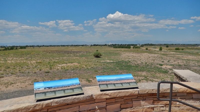 Early Years of Statehood In the early years of statehood, silver strikes at Leadville and Aspen brought settlers and money into Colorado. Rail lines, smelters, and refineries were built, and large coalfields were opened up. . . .