Kansas, Butler County, El Dorado
![]()
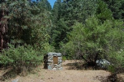
This house was built in 1918 at 800½ South Main Street, El Dorado, Kansas, (Gordon's Addition, Lot 5, Block 4) in direct response to the oil boom and the massive amounts of people moving to the area looking for housing. Originally the home was two single-room rentals. Later the wall was opened up and the house was rented as a two room home. This is an excellent example of the type of rental housing that was available to the oil boomers. It also shows the quick thinking of El Dorado citizens, who built rental houses onto the back portion of their lots for additional income.
Grandma Mary Elizabeth Anderson rented and lived in this house from 1931 until the early 1950s. She rented the home from a Mr. Cropson, a radio repairman, who owned and lived in the property in front of this house.
The house was never modernized with running water or plumbing. There was a water hydrant just outside the kitchen door and farther back was the outhouse.
Grandma Anderson was born in 1872 and was 59 years old when she started renting this house. She had nine children from 1893 until 1912. She and her husband, Lewis Anderson, moved to El Dorado in 1919. Her children were all grown and had left home by the time she began renting this two room house. But family visited and stayed with her often in this home.
After Grandma Anderson's death, her granddaughter Barbara Redburn, purchased the house for $2,600 in September 1986. It was moved to one mile east of Cambridge, Kansas by Ralph Hobson to be restored in memory of her beloved Grandmother. When the museum began the oil town living history area, the Redburns donated the house and all its contents to the museum.
(Industry & Commerce • Man-Made Features • Settlements & Settlers) Includes location, directions, 2 photos, GPS coordinates, map.


 Free blacks and slaves living west of Second St. and north of Broad St. founded the Third African Baptist Church in 1857. In 1858, it was dedicated on this site as Ebenezer Baptist Church, with a white minister, the Rev. William T. Lindsay, as pastor, as required by law. On 21 May 1865, the Rev. Peter Randolph became the congregation’s first black pastor. The church made education one of its chief goals. It opened the first public school for black children in Richmond in 1866, organized Hartshorn Memorial College for black women in 1883, and helped found the Richmond Colored Young Men’s Christian Association in 1887.
 Est. in 1933; closed 1956.
 A mining town was settled here on Corral Bar in 1890, and named after Chloride Mine locator Dan C. Dedrick. The post office was established May 4, 1891. By 1902 the town boasted a school, 2 stores, 2 hotels, a restaurant, lodging house, livery, assay house, 3 saloons and many homes. 200 men were employed in the mines in the area including Buck’s Ranch, Ralston, Annie, Maple, Mason-Thayer, Chloride-Bailey and the Globe. The Globe assayed at $750 per ton Sept. 20, 1890. The Globe and the Chloride used tramline buckets to bring ore to the two mills on Canyon Creek. The 40 stamp Globe mill was 20 stories tall. Mining activity slowed by the mid-1920’s with the lack of ore. Dedrick faded, and the post office closed December 31, 1941.
 Portales derives its name from the porch-like appearance of a cave entrance at nearby Portales Springs. It developed as a major peanut producing region in the early twentieth century, after the Pecos Valley Railroad opened the area for commercial agricultural development. Eastern New Mexico University was founded here in 1934.


 Founded 1874 as a mission of Trinity Church. In 1876 became an independent parish under the Rev. Jeremiah Ward, Rector.
 Early Galveston hotel; built 1847 by John Seabrook Sydnor, Galveston mayor 1846-1847.
 Human inhabitation of Kinney County began thousands of years ago. Spanish expeditions through the area began in 1535 and continued throughout subsequent centuries. An attempt at establishing a Franciscan mission in 1775 failed, as did settlement by Dr. John Charles Beales in 1834. Despite the hardships found in the area, Kinney County was carved out of Bexar County in 1850, two years before the U.S. Army opened Fort Clark as a frontier outpost. That same year, in 1852, local inhabitants established the Brackett settlement, named for Oscar B. Brackett who set up a stage stop, freight office and dry goods store to service the stage line from San Antonio to El Paso.
 In design of a Teutonic Club; all stockholders were of German descent. Center for city's social life, 1876-1923, complex had an octagonal dance pavilion, tennis courts, bowling and tenpin alleys, bandstand, fountains. The complex was site of Galveston's first underground electrical conduits. When corporation was dissolved, Stanley E. (Pat) Kempner bought the property and gave it to the city of Galveston for park use.
 For more than half a century from the mid-1800’s the intersection of Lee Highway and Glebe Road was known as Wunders Crossroads after the family whose farm lay just northeast. Dr. Henry S. Wunder and his son George O. Wunder were leading citizens of the county. Glebe Road was then the “road to the falls.” It was later named for the glebe of Fairfax parish. Its northernmost portion was part of the Little Falls Road from Falls Church. Lee Highway, originally the Georgetown-Fairfax Road was renamed to honor Robert E. Lee.


