Utah, Washington County, Santa Clara
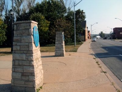
![]() Right from the beginning, the Santa Clara Merc developed a presence on the main street of this small western town. Morphing from a one-room operation to a small, free-standing unit to a thriving mercantile that supplied needed essentials to residents and jobs for many of its youth, the Merc was the heart of Santa Clara. The building's design is simple, reflecting the austere modern influence of the times with little architectural ornamentation, but the operation of the business wove a rich legacy. The story began long before construction took place, and it is best remembered through the writing of Ethel H. McArthur, a woman who personally knew the history.
Right from the beginning, the Santa Clara Merc developed a presence on the main street of this small western town. Morphing from a one-room operation to a small, free-standing unit to a thriving mercantile that supplied needed essentials to residents and jobs for many of its youth, the Merc was the heart of Santa Clara. The building's design is simple, reflecting the austere modern influence of the times with little architectural ornamentation, but the operation of the business wove a rich legacy. The story began long before construction took place, and it is best remembered through the writing of Ethel H. McArthur, a woman who personally knew the history.
The early citizens of Santa Clara were tired of having to go by wagon to St. George for their meager supplies, so a group of them got together and decided to open their own store. None of them had any experience running a mercantile business, but they chose John G. Hafen to be the manager…Before long, Grandpa Hafen brought the other stockholders out and with the small capital of ten dollars began to build up a mercantile business of his own. His work took him from home so much that the work in the store was done largely by grandmother.
The store was a small room in their home, but the business continued to increase, so in 1900 a small brick building was erected adjoining their house. The business remained at this location even though grandpa retired in 1917 and sold the business to his son Adolph and two grandchildren. It continued to be a general store, handling all varieties of goods needed by a community. It was the only mercantile ever established in Santa Clara.
In 1928 a new modern building of concrete block and adobe was constructed one block west of the original site. It was a much larger store and also had space for a large garage. The garage was rented to the Stucki & Wittwer Produce Company, and gas pumps were installed outside the store.
The new store was named the Santa Clara Coop and was still owned by the Hafens. In the late 1930's merchandise became extremely difficult to buy, and the inventory dwindled to almost nothing. The store was sold to Adolph's daughter Ethel and husband Horace McArthur. They moved home from California and took over operations on September 1, 1945. The majority of Adolph's business was run on credit, and this tradition became a way of life when dealing with McArthur's Santa Clara Merc.
Horace and Ethel expanded the store and its merchandise. The Merc was known to sell dishes, appliances, horseshoes, nails, dresses, shoes, fabric, toys and the town's first television. In 1960 Horace's son Douglas was made manager, and he and Ethel operated the business until July 1, 1986. The business started by John G. Hafen was then sold, leaving family hands for the first time in more than one hundred years.
The Santa Clara Merc continued to operate for another ten years until the competition of modern supermarkets forced it to close.
(Industry & Commerce • Settlements & Settlers) Includes location, directions, 3 photos, GPS coordinates, map.
 Right from the beginning, the Santa Clara Merc developed a presence on the main street of this small western town. Morphing from a one-room operation to a small, free-standing unit to a thriving mercantile that supplied needed essentials to residents and jobs for many of its youth, the Merc was the heart of Santa Clara. The building's design is simple, reflecting the austere modern influence of the times with little architectural ornamentation, but the operation of the business wove a rich legacy. The story began long before construction took place, and it is best remembered through the writing of Ethel H. McArthur, a woman who personally knew the history.
The early citizens of Santa Clara were tired of having to go by wagon to St. George for their meager supplies, so a group of them got together and decided to open their own store. None of them had any experience running a mercantile business, but they chose John G. Hafen to be the manager…Before long, Grandpa Hafen brought the other stockholders out and with the small capital of ten dollars began to build up a mercantile business of his own. His work took him from home so much that the work in the store was done largely by grandmother.
The store was a small room in their home, but the business continued to increase, so in 1900 a small brick building was erected adjoining their house. The business remained at this location even though grandpa retired in 1917 and sold the business to his son Adolph and two grandchildren. It continued to be a general store, handling all varieties of goods needed by a community. It was the only mercantile ever established in Santa Clara.
In 1928 a new modern building of concrete block and adobe was constructed one block west of the original site. It was a much larger store and also had space for a large garage. The garage was rented to the Stucki & Wittwer Produce Company, and gas pumps were installed outside the store.
The new store was named the Santa Clara Coop and was still owned by the Hafens. In the late 1930's merchandise became extremely difficult to buy, and the inventory dwindled to almost nothing. The store was sold to Adolph's daughter Ethel and husband Horace McArthur. They moved home from California and took over operations on September 1, 1945. The majority of Adolph's business was run on credit, and this tradition became a way of life when dealing with McArthur's Santa Clara Merc.
Horace and Ethel expanded the store and its merchandise. The Merc was known to sell dishes, appliances, horseshoes, nails, dresses, shoes, fabric, toys and the town's first television. In 1960 Horace's son Douglas was made manager, and he and Ethel operated the business until July 1, 1986. The business started by John G. Hafen was then sold, leaving family hands for the first time in more than one hundred years.
The Santa Clara Merc continued to operate for another ten years until the competition of modern supermarkets forced it to close.
(Industry & Commerce • Settlements & Settlers) Includes location, directions, 3 photos, GPS coordinates, map.


 In May, 1822, a Fort Snelling drummer boy named Joseph R. Brown and his friend, William Snelling, son of the fort's commander, canoed up what is now called Minnehaha Creek to "discover" a lake long sacred to the Indian people who built burial mounds along its shores. Thirty years later, the 23-square-mile natural lake with 110 miles of indented shoreline was named "Minnetonka" -- Dakota for "Great Piece of Water" -- by Governor Alexander Ramsey.


 Constructed in c.1887, the Old Philips Congregational Church is one of the few remaining structures dating from the old Philips Community. Later erased by twentieth century sub-divisions, this rural 19th century community was named after Albert Gallatin Philips, owner of nearby Red Bank Plantation. Although the actual construction date is not known, it appears that the current building, based on its "Carpenter Gothic" style and materials, was constructed soon after the Philips Congregational Society acquired the property in June of 1886. Through the joint efforts of District Council members, Matt Carlucci, and Reggie Fullwood, the City of Jacksonville in 2001 purchased this historic church to house the United Community of Outreach Ministries (UCOM).

 In order to provide timber for the construction of his El Paso & Northeastern Railroad north of Alamagordo, Charles B. Eddy in 1898 built a spur into the Sacramento Mountains. The line operated as far as Cloudcroft until 1947. The Cloudcroft Trestle is all that remains.
 The Valley Preferred Cycling Center, the most celebrated velodrome in modern American cycling history, traces its roots to the dream of one inspired visionary and its legendary success to the dreams of countless champions who began their trek to glory on its 333-meter track.
The concrete crater in a cornfield was the idea of publisher Bob Rodale. Rodale fell in love with track cycling while competing in skeet shooting at the Mexico Olympic Games in 1968. The president of Rodale Press and later publisher of Bicycling and Mountain Bike magazines knew in his heart that the excitement and colorful action of this healthful sport could capture the interest of Americans.
Construction began in 1974 on a plot of land in Trexlertown, Pennsylvania owned by Bob and Ardie Rodale. As the work progressed and the track took shape, Rodale worked with community leaders to create programs such as the Air Products Developmental Cycling Program that would develop new young local riders.
Rodale reached out to two of the most celebrated cyclists of the 1960s and 1970s Jack Simes III and David Chauner to bring his dream to life. Working with the late Artie Greenburg and announcer Brian Drebber, Simes and Chauner launched an immediate effort to attract top international cyclists and events.
When the first race was held on October 12, 1975, there were no locker rooms for the athletes, no seats for the fans, and no railing at the top of the track. From those early days legendary athletes such as Jerry "The Gentle Giant" Ash, Leigh "the Tree" Barczewski, Gil "Gabby" Hatton, Sheila Young, and Connie Paraskevin reignited the sport of track cycling in the United States, and Rodale's dream caught the imagination of the American cycling public.
Soon after the track's completion, Rodale donated the land to Lehigh County in return for a pledge that the county would continue to support development of the track and its programs. In 1979, the Trexlertown Velodrome, or "T-Town", as it is still affectionately called by the national and international racers who make their home here each summer, was renamed the Lehigh County Velodrome.
The velodrome is now managed by The Velodrome Fund, a nonprofit 501(c)3 foundation that continues to promote track cycling. Thanks to the generosity of Valley Preferred, a community partnership of doctors and hospitals, the newly renamed Valley Preferred Cycling Center continues to lead the nation in quality competition, championship racer development, and community programs that offer the opportunity for racers and non-racers to enjoy the thrill of bicycling track racing in the nation's most loved and most successful velodrome.
The Valley Preferred Cycling Center, the most celebrated velodrome in modern American cycling history, traces its roots to the dream of one inspired visionary and its legendary success to the dreams of countless champions who began their trek to glory on its 333-meter track.
The concrete crater in a cornfield was the idea of publisher Bob Rodale. Rodale fell in love with track cycling while competing in skeet shooting at the Mexico Olympic Games in 1968. The president of Rodale Press and later publisher of Bicycling and Mountain Bike magazines knew in his heart that the excitement and colorful action of this healthful sport could capture the interest of Americans.
Construction began in 1974 on a plot of land in Trexlertown, Pennsylvania owned by Bob and Ardie Rodale. As the work progressed and the track took shape, Rodale worked with community leaders to create programs such as the Air Products Developmental Cycling Program that would develop new young local riders.
Rodale reached out to two of the most celebrated cyclists of the 1960s and 1970s Jack Simes III and David Chauner to bring his dream to life. Working with the late Artie Greenburg and announcer Brian Drebber, Simes and Chauner launched an immediate effort to attract top international cyclists and events.
When the first race was held on October 12, 1975, there were no locker rooms for the athletes, no seats for the fans, and no railing at the top of the track. From those early days legendary athletes such as Jerry "The Gentle Giant" Ash, Leigh "the Tree" Barczewski, Gil "Gabby" Hatton, Sheila Young, and Connie Paraskevin reignited the sport of track cycling in the United States, and Rodale's dream caught the imagination of the American cycling public.
Soon after the track's completion, Rodale donated the land to Lehigh County in return for a pledge that the county would continue to support development of the track and its programs. In 1979, the Trexlertown Velodrome, or "T-Town", as it is still affectionately called by the national and international racers who make their home here each summer, was renamed the Lehigh County Velodrome.
The velodrome is now managed by The Velodrome Fund, a nonprofit 501(c)3 foundation that continues to promote track cycling. Thanks to the generosity of Valley Preferred, a community partnership of doctors and hospitals, the newly renamed Valley Preferred Cycling Center continues to lead the nation in quality competition, championship racer development, and community programs that offer the opportunity for racers and non-racers to enjoy the thrill of bicycling track racing in the nation's most loved and most successful velodrome. The Henry Hug family came to Santa Clara with the original Swiss Company in November of 1861. The Hugs and other members of this group lived in their wagon boxes and hillside dugouts until more adequate shelters could be built. The Hugs built this home in 1870. The original structure consisted of a dirt cellar, with two rooms overhead on the main floor and an attic room with a tiny, twisting staircase. The original walls were sandstone block and adobe brick. Original bricks are still visible in the attic along with the beams that are said to be from timber taken from Pine Valley Mountain. The Hugs stayed in the Santa Clara Valley until they sold the home to John and Anna Gubler in 1880. Sometime in the 1920s-1930s, the home was remodeled to include a modern kitchen and bathroom. The house was stuccoed at an unknown date, presumably to reinforce the original adobe brick.
 From around 1830 to 1860, thousands of freedom seekers used the Underground Railroad to reach sanctuary in Canada - the “promised land”. Many crossed the Niagara River from the United State to Fort Erie, including Josiah Henson and his family, who arrived on the 28th of October 1830. The book Uncle Tom’s Cabin, by Harriet Beecher Stowe, was patterned after his life.

 Throughout the 1800s there were many ferry landings competing for business along the Niagara River. The map below is a compilation of some of these locations.
 Over the centuries there have been many ferry landings along the Niagara River. Some were built by local merchants and some as government licenced landing points.

 “If the captain wants me, he may come himself and if he does I will shoot him.”
 Genesee Methodist Conference met here July 1820.


