Quantcast
Channel: The Historical Marker Database - New Entries
Viewing all 103809 articles
Browse latest View live

General Richard Montgomery

$
0
0
Quebec, Capitale-Nationale (region), Québec
To the memory of General Richard Montgomery who fell at Pres de Ville, at the foot of Cape Diamond during the December 31, 1775 attack. The next day, his body was brought to the house of Jean Gaubert which stood on this spot, and encoffined prior to his burial.

French:
À la memoire du General Richard Montgomery tombe a Pres de Ville, au pied du Cap Diamant, dans l’attaque du 31 December 1775. Son corps fut transporte le lendemain à la maison de Jean Gaubert, située ici même, pour y être place dans un cercueil convenable avant son inhumation.

Plaque apposée a la requête de la Société Historique de Québec par les soins du Ministère des Affaires Culturelles en 1975

(Cemeteries & Burial Sites • War, US Revolutionary) Includes location, directions, 2 photos, GPS coordinates, map.

Wolfe Monument

$
0
0
Quebec, Capitale-Nationale (region), Québec
Four panels are place on this monument to General James Wolfe.
English:
Here died
Wolfe
September 13th
1759

This monument was erected by the British Army in Canada A.D. 1849 by his Excellency Lt. Gen. Sir Benjamin D’Urban, Commander of Forces, in replacement of the one erected by the Governor General Lord Aylmer, G.C.B., in 1832 and destroyed with pieces remaining under present monument.

The first monument was a stone which the army rolled here to indicate the spot where Wolf died in 1756
A second monument was erected in 1832
The third one was erected by the British Army stationed in Canada, 1849
The fourth monument reproduced the column of the third one with the same decorative helmet, two inscriptions and erected by the National Battlefields Commission, 1913

This fifth memorial was erected by the National Battlefields Commission in July 1965 in replacement of the column which was destroyed on March 26th 1963

French:
Ici mourut
Wolfe
Le treize septembre
1759

Ce monument fut érige par l’armée britannique au Canada A.D. 1849 par son excellence Lieut. Genl. Sir Benjamin D’Urban, commandant des forces, remplaçant celui érige par le gouverneur Gen. Lord Aylmer G.C.B., et qui fut démoli en 1832. Les debris du premier monument sont enfouis sous celui-ci.

Le premier monument fut la pierre que l’armée meme roula ice afin de marquer d’endroit où Wolfe mourut, 1759
Un deuxième monument fut érige en 1832
Le troisième monument fut érige par l’armée britannique cantonnée au Canada, 1849
Le quatrième monument reproduisit la colonne du troisième gardant les pieces de tete et deux inscriptions, et fut érige par commission des champs de Bataille nationaux.

Ce cinquième monument fut érige par la commission des champs de Bataille nationaux en juillet 1965 afin le remplacer la colonne qui fut détruite le 19 mars 1963.

(War, French and Indian) Includes location, directions, 6 photos, GPS coordinates, map.

Konza Prairie

$
0
0
Kansas, Riley County, near Manhattan

Konza Prairie Research Natural Area is an 8,600 acre tallgrass prairie preserve owned by The Nature Conservancy and managed by the Division of Biology at Kansas State University. You are standing on the northeast corner of the site which stretches south for five miles to Interstate 70 and four miles west. The Konza Prairie is one of the largest land tracts in North America dedicated to research on the ecological processes that characterize and maintain the tallgrass prairie. Research at the site is supported by Kansas State University, The Nature Conservancy, the Kansas Agricultural Experimental Science Foundation, and numerous other agencies.

Major research programs involve the primary forces that shape the prairie - fire, grazing by large mammals, and climate. Over 50 watersheds on Konza Prairie are systematically burned. Burning occurs at variable frequencies (every 1, 2, 4, 10, or 20 years) and during different seasons. Burning is used to analyze how the natural phenomenon of fire affects and sustains the tallgrass prairie. In addition, native bison and domestic livestock graze selected watersheds to determine how the interaction of grazers and fire influence the biological diversity and productivity of the prairie ecosystem. Researchers from across the United States and the world come to Kansas State University to study soils; hydrology; and plant, insect, bird, and mammal populations in the Konza's unique living laboratory.

Access to Konza Prairie is limited due to the ongoing scientific research and the presence of bison. However, a public nature trail is open daily from dawn to dusk, accessible from the preserve entrance 6 miles south of Manhattan on McDowell Creek Road.

(Environment) Includes location, directions, 5 photos, GPS coordinates, map.

Geology at Konza

$
0
0
Kansas, Riley County, near Manhattan

The image on this plaque depicts your view of the Konza Prairie and the Kansas River Valley. Looking from west to southwest, the view is typical of the Flint Hills in their natural state. Due west is the floodplain of the Kansas River and to the southwest, along the horizon, are two low rounded hills. The difference in elevation from the grass covered hilltops to the wooded stream valleys is about 400 feet. Given the opportunity to explore the landscape of the image, you would find clues to the underlying geology of the Flint Hills. A hike, along a stream valley or an eroded hillside, would allow you to see layers of exposed sedimentary rocks: limestones (some with chert/flint) and mudrocks. These exposed rocks are between 240 and 290 million years old. Geologists refer to rocks of this age as Permian. Originally described in the 1800s, the name "Permian" is taken from similar rock formations of the southern Ural Mountains located near the town of Perm, Russia.

Careful study of fossils and related features show that the region's sedimentary rocks were formed from sediments deposited on the bottom of an ancient shallow sea. The climate of this ancient marine environment was very dry, much like parts of the Persian Gulf during the twentieth century. Limestone layers (A, B, C, and E) and some thin mudrock layers record these marine conditions. Thicker mudrock layers (D) provide evidence of ancient soils. These ancient soils developed when sea level lowered and exposed the area to terrestrial processes in the present day climate, thick mudrock layers weathered (decompose or disintegrate) easily. The weathering of these layers form the hillsides and valleys of the view you now see. Limestones, with their numerous layers of chert/flint, are more resistant to weathering than the softer mudrock layers. It is the limestone layers which cap the hills or create prominent ledges in the hillsides. The chert/flint, found near the surface, is harder than steel, making it difficult to plow and cultivate the soil. It is this distinctive geologic feature which preserves the native conditions of the region and gives the region its name: THE FLINT HILLS.

(Environment • Paleontology) Includes location, directions, 6 photos, GPS coordinates, map.

The Tallgrass Prairie

$
0
0
Kansas, Riley County, near Manhattan

"As to scenery, while I know the standard claim is that Yosemite, Niagara Falls, the Upper Yellowstone, and the like afford the greatest natural shows, I am not so sure but the prairies and plains, while less stunning at first sight, last longer, fill the esthetic sense fuller, precede all the rest, and make North America's characteristic landscape. Even the prairie's simplest statistics are sublime."
- Walt Whitman

At first sight, the tallgrass prairie appears to be a monotonous sea of grass, and indeed it is dominated by a handful of tall perennial grasses such as big bluestem, little bluestem, Indian grass, and switchgrass. However, closer inspection reveals its wealth of biological diversity. The grassland, woodland, and stream habitats of Konza contain over 600 species of plants, approximately 300 species of vertebrates (mammals, birds, reptiles, amphibians, and fishes) and several hundred species of insects, small soil organisms, and aquatic organisms. This diversity is maintained by complex interactions of grazers, fire, topography, soils, and a variable mid-continental climate.

The tallgrass prairie once stretched over most of what is now Iowa, Illinois, southern Minnesota, northern Missouri, and the eastern portions of the Dakotas, Nebraska, Kansas, and Oklahoma. Most of this region was converted to farmland during the westward expansion in the 1800's. As a result, only a small fraction of the original prairie remains. The exception is the Kansas Flint Hills where steep slopes and rocky soils defied the plow. Within the Flint Hills region, approximately 5 million acres remain as the largest contiguous area of tall grass prairie in North America. Today, the key ecological processes of periodic fire and grazing are important management practices in Flint Hills prairie.

(Environment) Includes location, directions, 6 photos, GPS coordinates, map.

Road to Battle

$
0
0
Maryland, Queen Annes County, Grasonville
About 300 British soldiers approached Queenstown by road on August 13, 1813. Their part in a two-pronged attack involved a steamy march across Kent Island and The Narrows, towing two field cannon. The nighttime march was interrupted near dawn by a skirmish with Americans at a rise in the road known as Slippery Hill. The British continued on to Queenstown, but the American militia had escaped to Centreville.

“At 10 minutes before 3 o’clock of the 13th I was aroused by the quick approach of horsemen…with the intelligence that the enemy was approaching in great force on the main road from Kent Narrows to Queen’s Town.”
Major William H. Nicholson, Maryland Militia, August 16, 1813.

Reconnaissance
According to a British officer’s report, the day before the march a Captain Robertson “got acquainted with the road.” He gathered the information while protected by a flag of truce.

(Inscription beside the image on the right)
An encounter with American picket guards at Slippery Hill effectively ended the British attack on Queenstown.

(War of 1812) Includes location, directions, 4 photos, GPS coordinates, map.

Historic National Bankhead Highway

$
0
0
Texas, Callahan County, Baird
The Baird area was the mid-point of the first all weather two land highway from Savannah, Ga. To San Diego, California. The Naval Division Branch connected Washington D.C. to Norfolk, Virginia.

Named for Alabama Senator John Hollis Bankhead, the ambitious project involved fourteen states from coast to coast. It provided many with badly needed employment in the 1920's and 1930's while creating a dependable route for military convoys.

An important lifeline for towns along its 3,000 mile route, the “Broadway of America” provided the traveler of yesteryear a new adventure – the cross country automobile road trip.

The main Texas route paralleled the Texas and Pacific Railroad from Texarkana to El Paso. In Baird the road traveled past the courthouse, down Market Street one block and continued west on present day Farm Road 18 to Callahan County’s western boundary.

Today, the Bankhead Highway is still a thriving main street of many Texas Towns.

(Roads & Vehicles) Includes location, directions, 4 photos, GPS coordinates, map.

Pioneers

$
0
0
Texas, Callahan County, Baird


County Organized
July 3, 1877
Named for
James H. Callahan
Ranger Captain
and
Indian Fighter

(Settlements & Settlers) Includes location, directions, 3 photos, GPS coordinates, map.

Jonathan Sewell

$
0
0
Quebec, Capitale-Nationale (region), Québec
English:
Thirty years Chief Justice of Lower Canada, Adviser to Governor Craig, Leader of the “Chateau Clique”, Early advocate of Confederation, Man of culture and patron of the arts.
Born Cambridge, Mass 6th June, 1766
Died in this house, 12th November, 1839

French:
Juge en chef du Bas-Canada durant trente ans, Conseiller du Gouverneur Craig, Chef de la “Clique du Château”, Protagoniste de la Confédération, Homme de grande culture et protecteur des arts.
Né à Cambridge, Mass., le 6 juin 1766
Décédé dans cette maison, le 12 novembre 1839

(Notable Persons) Includes location, directions, 3 photos, GPS coordinates, map.

Premier Hôpital au Canada

$
0
0
Quebec, Capitale-Nationale (region), Québec
English:
The Hotel-Dieu of Quebec, founded on the 16th August, 1637 by the Duchesse d’Aiguillon and the Augustines Hospitalieres de Dieppe, is the first hospital established in America, north of Mexico. Here, ever since their arrival in 1639, the Augustines have ministered to alleviate human suffering

French:
L’Hôtel-Dieu de Québec, fondé 16 août 1637, par la Duchesse d’Aiguillon et les Augustines Hospitalieres de Dieppe, est le premier hôpital établi en Amérique au nord du Mexique. Arrivées en 1639, les Augustines s’y dévouent, depuis lors, au soulagement des souffrances humaines.

(Science & Medicine) Includes location, directions, 3 photos, GPS coordinates, map.

The Quebec Conferences

$
0
0
Quebec, Capitale-Nationale (region), Québec
English:
During the Second World War, on the invitation of the Prime Minister of Canada, W.L. Mackenzie King, the President of the United States, Franklin D. Roosevelt, and the Prime Minister of the United Kingdom, Winston S. Churchill, met in conference at this Citadel on two occasions (August 10 to 24, 1943 and September 11 to 16, 1944) to consider the strategy of allied victory.

French:
Au cours de la seconde guerre mondiale, sur l'invitation du Premier-Ministre du Canada W. L. Mackenzie King, le Président des États-Unis, Franklin D. Roosevelt, et le Premier Ministre du Royaume-Uni, Winston S. Churchill, tinrent deux conférences dans cette citadelle, (du 10 au 24 août 1943 et du 11 au 16 septembre 1944), afin d'étudier la stratégie de la victoire alliée.

(War, World II) Includes location, directions, 3 photos, GPS coordinates, map.

Hôtel-Dieu de Québec

$
0
0
Quebec, Capitale-Nationale (region), Québec
English:
Founded on 16 August 1637 by the Duchess of Aiguillon and the religious order of the Augustines Hospitalières of Dieppe, the Hôtel-Dieu de Québec was the first permanent hospital established north of Mexico. As soon as they arrived in Canada in 1639, the sisters dedicated themselves to the relief of human suffering. The stone walls of Hôtel-Dieu still enclose a hospital, a monastery and a church, as well as a garden and a cemetery, all evidence of the life of this once cloistered community committed to its nursing mission for over 350 years.

French:
Fondé le 16 août 1637 par la duchesse d'Aiguillon et les Augustines Hospitalières de Dieppe, l'Hôtel-Dieu de Québec est le premier hôpital permanent établi au nord du Mexique. Dès leur arrivée au Canada en 1639, les religieuses consacrent tous leurs efforts à soulager la souffrance humaine. Derrière l'enceinte de pierre de l'Hôtel-Dieu subsistent l'hôpital, le monastère, l'église ainsi que le jardin et le cimetière, témoins de la vie d'une communauté jadis cloîtrée qui a su maintenir des liens étroits avec son oeuvre hospitalière pendant plus de 350 ans.

(Charity & Public Work • Science & Medicine) Includes location, directions, 3 photos, GPS coordinates, map.

The Québec Citadel

$
0
0
Quebec, Capitale-Nationale (region), Québec
English:
In 1820 Lieutenant-Colonel Elias Walker Durnford of the Royal Engineers took charge of the construction of the Québec Citadel, which completed the city's defensive works begun during the French régime. Set on the heights of Cap-aux-Diamants, the Citadel dominated the town, harbour and the surrounding countryside. The ramparts were completed in 1831, and the major buildings within the walls about 1850. The walls also contain Frontenac's 1693 redoubt and a 1750 powder magazine. Since 1872 the Citadel has been an official residence of the Governor General of Canada, who spends part of each year here.

French:
À partir de 1820, l'ingénieur royal Elias Walker Durnford dirige la construction de la citadelle de Québec. Il complète ainsi le système défensif de la ville dont les premiers ouvrages remontent au régime français. Aménagée sur les hauteurs du Cap-aux-Diamants, la citadelle domine la ville, la campagne et la rade de Québec. Son rempart est complété en 1831 et les principaux édifices à l'intérieur, vers 1850. On retrouve aussi la redoute du Cap construite en 1693 par Frontenac et une poudrière de 1750. Depuis 1872, la citadelle sert de résidence aux Gouverneurs généraux du Canada qui y séjournent tous les ans.

(Forts, Castles) Includes location, directions, 8 photos, GPS coordinates, map.

The Grande Allée Drill Hall

$
0
0
Quebec, Capitale-Nationale (region), Québec
English:
The Grande-Allée Drill Hall is an impressive example of a drill hall that retains its original parade square. Designed by Eugène-Étienne Taché, a Quebec public servant and architect, the stone building was completed in 1887, with an addition in 1913. The steeply pitched gable roof, conical towers and fanciful decorative details of the drill hall make it an early example of the French-inspired Chateau style. The use of the style here is unique among Canadian drill halls of this period and reflects the late 19th century interest in the historic French roots of the city.

French:
Le manège de la Grande-Allée constitue un exemple impressionnant d'un manège militaire qui a conservé son terrain d'exercice d'origine. Conçu par Eugène-Étienne Taché, fonctionnaire et architecte québécois, ce bâtiment de pierre a été achevé en 1887 et agrandi en 1913. Avec son toit abrupt à pignon, ses tours coniques et ses motifs fantaisistes, il forme un des premiers exemples du style Château d'inspiration française. Le choix de ce style, unique dans le cas des manèges militaires de l'époque au Canada, traduit bien l'intérêt manifesté vers la fin du XIXe siècle envers les racines françaises de la ville.

(Forts, Castles) Includes location, directions, 2 photos, GPS coordinates, map.

Obadiah Baker Homestead

$
0
0
New York, Erie County, Orchard Park
Built in 1840 - replaced log cabin erected when property was acquired from Holland Land Company in 1804. The Baker family - prominent Quakers in this area - lived here for five generations. This home served as one last station of Underground Railway for slaves enroute to Canada via Buffalo.

(Abolition & Underground RR • Settlements & Settlers) Includes location, directions, 4 photos, GPS coordinates, map.

Harahey

$
0
0
Kansas, Riley County, Manhattan

Governed by
Chief Tatarrax
———————
Discovered by
Coronado 1541
———————
Rediscovered by
J.V. Brower 1896
Erected by
W. J. Griffing
and
F. B. Elliott
for
Quivira Historical Society
1904
———————
Kansas U.S.A.

(Exploration • Native Americans) Includes location, directions, 4 photos, GPS coordinates, map.

Civil War Memorial

$
0
0
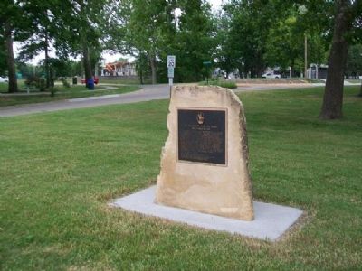
Kansas, Riley County, Manhattan

Dedicated
to
The Union Soldier
1861 - 1865

[Dedicated] Jan 2 - 1937

(Fraternal or Sororal Organizations • Patriots & Patriotism • War, US Civil) Includes location, directions, 2 photos, GPS coordinates, map.

Spanish American War Veterans Memorial

$
0
0
Kansas, Riley County, Manhattan

Dedicated
to
the memory
of the
Spanish American
War Veterans

1898 - 1902

[Dedicated] Oct 27 - 1937

(Fraternal or Sororal Organizations • Patriots & Patriotism • War, Spanish-American) Includes location, directions, 2 photos, GPS coordinates, map.

Ft. Leavenworth - Ft. Riley Military Road

$
0
0
Kansas, Riley County, Manhattan

After crossing the Blue River and entering Riley County at the foot of Poyntz Avenue, "The Great Military Road" proceeded west to this point, where it angled off southwest passing through Theodore Roosevelt School grounds, Longs Park, and squeezed between the south end of the ridge in Sunset Park and the Kansas River channel, where Ft. Riley Blvd. is now located. From this marker, two additional branches angled off, one to the north to the Rocky Ford area, and one to the northwest where it joined "The Old Indian Trail" in the vicinity of Cico Park. Albert D. Richardson, alnog with Horace Greeley, both New York Tribune journalists, passing through Manhattan in 1859 on their way to the Colorado gold fields, described Manhattan as "a flourishing Yankee settlement of two or three hundred people."

Text by Morris Werner

(Man-Made Features • Roads & Vehicles) Includes location, directions, 2 photos, GPS coordinates, map.

1897 Model "French 75"

$
0
0
Wisconsin, Jackson County, Black River Falls
Since its introduction in 1897, the "French 75" was first used in World War I by both the French and the Untied States. It was the U.S. Army's first modern artillery piece and is significant in the development of weaponry as the first gun fitted with a recoil mechanism.

Between the wars the wooden spoked wheels of the Model 97 were replaced with pneumatic tires to accommodate modern high speed warfare. During 1940 in World War II the "French 75" was used at the Maginot Line in the defense of France. Later, a large number of guns captured by the Germans were used to defend the French coast against the Allied invasion in 1944. There were only 17,000 of the "French 75" made including those manufactured under license in Mexico and the United States of America.

The majority of troopers in Company C, 107th Ammunition Train, 32nd Infantry Division, during World War I were Jackson County soldiers. Notations made in diaries kept by Corporals Eilert Hagen and Sigurd Hanson of the Unit indicated a number of nights when the "boys were out hauling 75's."

(Man-Made Features • War, World I • War, World II) Includes location, directions, 2 photos, GPS coordinates, map.
Viewing all 103809 articles
Browse latest View live


Latest Images