Quantcast
Channel: The Historical Marker Database - New Entries
Viewing all 103859 articles
Browse latest View live

Fort Walthour

$
0
0
Pennsylvania, Westmoreland County, Irwin
Erected about 1774 near this place
This stockade, enclosing a blockhouse and several buildings, was built by the pioneers of the Brush Creek community on the plantation of Christopher Walthour. It was the chief place of refuge and defense of the early settlers for more than a decade against the frequent Indian raids made in this section and throughout western Pennsylvania.

(Forts, Castles • Native Americans) Includes location, directions, 2 photos, GPS coordinates, map.

Original Settler's Cabin

$
0
0
Pennsylvania, Allegheny County, Pleasant Hills
This log cabin, typical of the log cabins built by the first white settlers, is one of the very few original log cabins in Allegheny County. It was in cabins such as this that our forefathers established their hold on the soil and raised the first family of pioneer children.

This cabin has been rebuilt to the exact original size, using eight of the original logs and the original rafters. It has the appearance of the original cabin which stood on the same location, but twelve feet lower. When the property was acquired by Jefferson Memorial Park in 1929 the cabin was then in a deep gully, near a beautiful, never-failing spring located a few feet away, coming from beneath the roots of a giant white oak tree which sheltered from spying Indian eyes not only the spring, which has now become a well, but also the cabin.

Jacob Beam originally staked out his claim to the tract of 160 acres of land and built this cabin in 1782. The tract was surveyed pursuant to a warrant to Jacob Beam dated February 10th, 1785, and on January 6th, 1798, was deeded to to him by the Commonwealth of Pennsylvania under the authority of Thomas Mifflin, Pennsylvania's first governor. (deed may be viewed in administration building)

Jacob Beam had another tract of land a few miles east of this one and about 1800 he sold this tract to Aaron Work, whose descendants held the property until it was acquired in 1929 by Harry C. Neel, a great-great-grandson of Aaron, and founder of Jefferson Memorial Park.

(Cemeteries & Burial Sites • Native Americans • Settlements & Settlers) Includes location, directions, 6 photos, GPS coordinates, map.

Ebracher House

$
0
0
Germany, Bavaria, Kreis Kitzingen, Iphofen
1557 erwarben die Bracher
Zisterzienser dieser Hof.
Schultheiß, Bürgermeister und Rat
"transferierten alle und jede Herrlichkeit und Freiheit,
so auf den dem früherem, gänzlich gefreiten
Eigentum geruht, auf dieses Gebäude."
In Anerkennung dieses Entgegenkommens überreichte die Abtei der Stadt 100 Gulden, "damit sie dieses nachbarlichen und gueten Willens desto mehr ergetzlich befinden möge."
Bis 1712 war der Hof Wohnung für den Kästner
und Verwaltungsgebäude.
Im Schüttboden und im Keller wurden die Abgaben
der Ebracher Grundholden aus Iphofen und den
umliegende Ortschaften gelagert.
Qu: Stadt Arch. Iph.

Marker text translated into English:
In 1557 the Cistercian Brothers of Ebrach acquired this house. The village mayor, grand mayor, and city council "transferred any and all corporate rights and freedoms" from the former building owners to the Cistercians. In recognition of this accommodation, the Abbey (of Ebrach) gave the city 100 guilders, "that it might preserve the delightful goodwill between them." Until 1712 the building was the home for the granger (granary keeper) and an administrative building. The levies for Ebrach Abbey from Iphofen and the surrounding villages were stored in the building's granary and basement.

Source: Iphofen City Archives


(Agriculture • Industry & Commerce) Includes location, directions, 2 photos, GPS coordinates, map.

Captures of Port Royal

$
0
0
Nova Scotia, Annapolis County, Annapolis Royal
In commemoration of the captures of Port Royal by New England expeditions under Maj. Robert Sedgwick 1654 and Colonel Francis Nicholson 1710. In this second expedition Col. Samuel Vetch was Adjutant-General. There were 36 transports, 4 ships of 60 guns each, 2 of 40 guns, 1 of 36 guns and 2 bomb galleys. The land forces were 1 regiment of marines, Col. Robert Reading, 2 regt. from Massachusetts under Col. Sir Chas. Hobby and Col. William Taylor, Col. Shadrach Walton’s New Hampshire Regt., Col. William Whitings’ Connecticut Regt. and Col. John Cranston’s Rhode Island Regt. The grenadiers were led by Captain Paul Mascarene.

(War, French and Indian) Includes location, directions, 4 photos, GPS coordinates, map.

Daniel Auger de Subercase

$
0
0
Nova Scotia, Annapolis County, Annapolis Royal
In memory of
Daniel Auger de Subercase
1663-1732
Chevalier of the Military Order of St. Louis, last French commander of this fort and defender of Acadie.

Honour to unsuccessful valour

(War, French and Indian) Includes location, directions, 2 photos, GPS coordinates, map.

Belle Prairie Church and Log Cabin

$
0
0
Minnesota, Morrison County, Little Falls


Belle Prairie, meaning, "beautiful prairie," was named by French fur traders and voyageurs. It was organized as a township on March 25, 1859. Belle Prairie was the home of the first school in Morrison County started in 1849 by Frederick Ayer. Belle Prairie is the home of Holy Family Parish, one of the oldest Catholic parishes in Minnesota.

Morrison County
Celebrating 150 Years
1856 - 2006

(Churches, Etc. • Exploration • Man-Made Features • Settlements & Settlers) Includes location, directions, 3 photos, GPS coordinates, map.

Sieur de Monts

$
0
0
Nova Scotia, Annapolis County, Annapolis Royal
To the illustrious memory of Lieut. Gen’l Timothé Pierre du Guast,
Sieur de Monts,
the pioneer of civilization in North America, who discovered and explored the adjacent river, A.D. 1604, and founded on its banks the first settlement of Europeans north of the Gulf of Mexico.
The government of Canada reverently dedicates this monument within sight of that settlement, A.D, 1904.

(Exploration • Settlements & Settlers) Includes location, directions, 3 photos, GPS coordinates, map.

Truby Cemetery

$
0
0
Texas, Jones County, near Hawley
Several gravestones at this site attest to its use as a burial ground by nearby settlers before members of the Daughtrey family, early area ranchers, formally deeded these three acres for cemetery use on December 4, 1906. The oldest marked grave is that of infant Madge S. McCargo (1897-1898), granddaughter of pioneer Baptist minister George W. Scarborough and his wife Martha, who settled on this land in 1877. Caring descendants erected a fence in the 1950s and a flagpole in 1998 out of respect for the pioneers, veterans, and citizens laid to rest here; their gravestones remain a chronicle of the heritage of Jones County.
Historic Texas Cemetery - 2000

Veterans of War
J.F. Bristow    12-10-1900    CSA
Isaac L. Lollar   7-11-1919    CSA
Eugene Bumpass    11-19-1955    WWI
Robert John Rhome    10-24-1975    WWI
Roy N. Sandidge    10-9-1918    WWI KIA
James W. McDuff    3-14-1932    Texas Guard
Leslie F. Lipham Jr.   10-18-1996    WWII
Al E. Newman    3-29-2001    WWII
Joseph H. Hampton    2-17-1998    Vietnam
Oscar Leo McIlroy    6-21-1973    WWII
Van L. Welch    9-8-2001    Vietnam

(Cemeteries & Burial Sites) Includes location, directions, 10 photos, GPS coordinates, map.

Site of Truby School

$
0
0
Texas, Jones County, near Hawley
Early educational efforts in this area date to the 1870s, prior to the organization of Jones County in 1881. The rural community of Truby encompassed School District No. 14 until consolidating with Bitter Creek schools in 1916 to become District No. 56. There were three earlier locations for Truby schools until this site was selected in 1916 and a new building was constructed. Truby School educated children through grade nine, with students traveling to Anson for high school after World War II, as the rural population declined, Truby consolidated with Anson schools, but the schoolhouse remained in use as a community center until the close of the 20th century.

(Education) Includes location, directions, 7 photos, GPS coordinates, map.

Port-Royal

$
0
0
Nova Scotia, Annapolis County, Annapolis Royal
English
When the French first came to the Annapolis Basin, Samuel de Champlain called it “Port-Royal” in recognition of its great size. Eventually, the area surrounding the basin and along the Annapolis River became known as Port-Royal.

French
Lorsque les Français arrivent pour le première fois dans le bassin de l’Annapolis, Champlain l’appelle «Port-Royal» pour souligner sa grand étendue. Par la suite, c’est la région entourant le bassin et le long de la rivière Annapolis que est appelée Port-Royal.

(Settlements & Settlers) Includes location, directions, 3 photos, GPS coordinates, map.

The Little Red Schoolhouse

$
0
0
Nebraska, Nemaha County, Peru


Known as the Center School, it became the landmark built at the corner of U.S. Highway 75 and the Brock Road.

It was disassembled brick-by-brick and reassembled on this site in 2001.

The Little Red Schoolhouse is dedicated
to the many teachers who trained at
Peru State College.

These teachers impacted the State and Nation
Then - Now - Always

(Education • Man-Made Features) Includes location, directions, 2 photos, GPS coordinates, map.

Queen’s Wharf

$
0
0
Nova Scotia, Annapolis County, Annapolis Royal
English
Since the 1740s, three wharves have been built where the ruins of the Queen’s Wharf now lie. Everything the fort needed was landed on the wharf: troops, provisions, weapons and much more. It served the needs of the military until the garrison was withdrawn in 1854.

Over the years, the wharf was redesigned and reconstructed as required and continued to be used by local residents into the 1900s. The ruins before you date to around 1906, when the wharf was last rebuilt.

French
Depuis les années 1740, trois quais sont construits là oû se trouvent maintenant les ruines du quai de la Couronne. À l’époque, tout ce dont le fort a besoin arrive à cet endroit: soldats, provisions, armes et tant d’autres choses. Le quai répond aux besoins de l’armée jusqu’au retrait de la garnison en 1854.

Au fil des années, le quai est redessiné et reconstruit en fonction des besoins, et les gens de l’endroit continuent à s’en servir jusque dans les années 1900. Les ruines que se trouvent devant vous remontent â environ 1906, époque où le quai est reconstruit pour la dernière fois.

(Waterways & Vessels) Includes location, directions, 2 photos, GPS coordinates, map.

Peru State College

$
0
0
Nebraska, Nemaha County, Peru


Peru State College, originally incorporated as Mount Vernon Seminary, became Nebraska's first state-supported college on June 20, 1867. The school was initially organized and largely financed by local residents, then offered to the Methodist Conference. When the Conference refused, the school was offered to the state.

Called the Nebraska State Normal School, Peru was one of the first of its kind west of the Missouri River. Its first classes as a state school were held on October 24, 1867, with thirty-two students enrolled in the normal department. The campus at that time contained sixty acres of land and one building, Mount Vernon Hall.

The school's purpose as outlined in the Legislative bill was to "instruct young people in the art of teaching and in the various branches that pertain to the good common school education, in mechanic arts, in the arts of husbandry and agricultural chemistry, in the fundamental laws of the United States, and in good citizenship."

During its first one hundred years, Peru State College expanded to a campus of one hundred acres dotted with twenty academic buildings and housing complexes to accommodate an enrollment of more than 1,100 students.

(Education) Includes location, directions, 2 photos, GPS coordinates, map.

Auburn Post Office Mural

$
0
0
Nebraska, Nemaha County, Auburn


During the 1930s, President Franklin D. Roosevelt's New Deal created government programs to counter the effects of the Great Depression. Hundreds of post offices were built and the U.S. Treasury commissioned art for many of them. Twelve Nebraska post offices were selected to receive murals.

Ethel Magafan, the artist for the Auburn project, chose a theme depicting local agriculture. The canvas was installed in the post office lobby in 1938. The post office is listed in the National Register of Historic Places.

(Arts, Letters, Music • Charity & Public Work • Man-Made Features) Includes location, directions, 6 photos, GPS coordinates, map.

First National Bank Building

$
0
0
Nebraska, Douglas County, Omaha


has been listed in the
National Register
of Historic Places

by the United States
Department of the Interior

(Notable Buildings) Includes location, directions, 2 photos, GPS coordinates, map.

Episcopal Church of Our Savior

$
0
0
Minnesota, Morrison County, Little Falls


This property has been
placed on the
National Register
of Historic Places

by the United States
Department of the Interior

(Churches, Etc.) Includes location, directions, 2 photos, GPS coordinates, map.

Cottonwood Twp. Evangelical Church and Cemetery

$
0
0
Minnesota, Brown County, near Searles

     In 1857, Rev. August Huelster held the first Evangelical church service at the home of Charles Lauer in Cottonwood Township. In 1865, two acres of land were purchased in Cottonwood Township by John Mohr, Philip Pfisterer & Carl Schreyer, trustees of the Evangelical Association. One acre was set aside as a cemetery & on the other a log church was built & dedicated Dec. 19, 1869. A log parsonage was added in 1870. The log church was replaced by a frame church during the ministry of Rev. Martin Gagstetter 1891-1894. By 1920, the congregation had dissolved, the land the church stood on was sold and the building moved into Searles. It was used for both commercial and residential purposes until it was torn down in 1968.

     The cemetery continued to be maintained by the association. The last burial was in 1955. In July of 1986, the cemetery was declared abandoned and the deed was turned over to the Brown County Commissioners. The cemetery has been restored and this marker erected with funds from the Evangelical Cemetery Association, the County of Brown, a grant from the Aid Association for Lutherans and the Brown County Historical Society.
         Dedicated July 9, 1989
(reverse) The Following Are Known to Be Buried in This Cemetery Christian F. Apitz • Salma Beyer • Barbara Bott • Four children of Peter Bott • Valentine Bott • Grandfather Eckert • Heinrich A. Emde • Lydia Emde • Two children of Carl Eagelbart • Ernest Engelbart • Fred Engelbart • Wm. Engelbart, Sr. & seven children: August, Gustaf, Herman, Katie, Fritz, Rebecca, & Robert • Christ Gaetke • Sophie Gaetke • Infant children of John Gaetke • Grandfather Grose • Hemrich Hamann • Louise Hamann & five children: August, Heinrich, Lanne, Martha, & Valden • Johann Hamann • Meta Heers • Margarett E. Aeim • Elias Jacobson • Mrs. Elias Jacobson • Johan Jahoke • Mary Jahoke • August Jeske • Sophie Jeske • Ferdinand Jeske • Katherine Jeske • Lily Jeske • William Jeske • Johann Ulrich Lipp • Anna M. Lipp • Four children of John Mohr: Henry G., Ida, H.L., Louise H., Wilhelm H. • Mrs. John Muhs, Sr. • Gottlieb Mannweiler • Hermann Moritz • John C. Ohme • Wilhamina Ohme • Dorothey Pfisterer • Philip Pfiesterer, Sr. • Philip Pfiesterer, Jr. • Dr. William Pfiesterer • Frederick Retzlaff • Ernestine Retzlaff • Frank C. Retzlaff • Mary A. Retzlaff • Henry E. Retzlaff • Herman A. Retzlaff • Otto F. Retzlaff • Rudolph Retzlaff • Charles Riefenstein • Rev. C. Louis Seder • Fred Schrapp, Sr. • Anna Schrapp • Louise Richter • Amelia Schreyer • Three children of Carl Schreyer: Bertha, Martha, & infant son • Gottlieb Schreyer • Maria Schreyer • Alfred Siebert • Christina Siebert • Henry Siebert, Sr. • Katharine Siebert • Susan Siebert • Conrad Stutz & seven children: Benjamin, Elizabeth, Louise, Sarah, William, & two infants • Johan C. Schumacher • Margaret Zick • Fred Zick, Jr. • Frederich Zick, Sr. • Caroline Zick • Lily Zick • William Zick & two children

(Cemeteries & Burial Sites • Churches, Etc.) Includes location, directions, 5 photos, GPS coordinates, map.

Nathan Richardson

$
0
0
Minnesota, Morrison County, Little Falls


Nathan Richardson, affectionately known as "Uncle Nate," was one of the founders of Morrison County when it was organized in 1856. He was later instrumental in expanding the county to include the portion on the west side of the Mississippi River. He assisted the Mille Lacs Band of Ojibwe with efforts to retain it's reservation, helped to develop the Little Falls & Dakota Railroad, and was Morrison County's first historian. Richardson has the distinction of holding more public offices than any other person in the history of the county

Minnesota State Legislator • Register of Deeds • Clerk of County Board of Commissioners • Judge of Probate • Mayor of Little Falls • Postmaster • County Attorney • County Auditor • Deputy State's Attorney • Captain of Home Guards • Chair of Little Falls Township Board • Election Clerk • President of Board of Education • County Census-taker

Text by Mary Warner

Commemorated this 2nd day of June, 2006 in celebration of Morrison County's Sesquicentennial year.

(Politics • Settlements & Settlers) Includes location, directions, 5 photos, GPS coordinates, map.

The Burton/Rosenmeier House

$
0
0
Minnesota, Morrison County, Little Falls


(Side A)
The Burton/Rosenmeier House is significant architecturally as the outstanding example of the Classical Revival style in Little Falls and for its associations with its first two inhabitants: The Barney Burton family and later the Rosenmeier family.

Barney Burton was the seventh of eight children born to Isaac and Sarah Burton, Polish immigrants, who settled in Peoria, Illinois, later migrating to Wisconsin. At the age of eighteen he moved to St. Cloud where he went into the clothing business with his brother, Jacob. In 1886 they moved to Little Falls seeking a better location. As the Little Falls community prospered during the "timber boom" years, so did Barney Burton who had dissolved the partnership as his brother moved on to other independent endeavors. He married Sara Deutsch, of Minneapolis, in 1894, and lost her through death at childbirth the following year. In 1898 Barney married a sister of Sara, Josephine Deutsch, a life-long relationship which bore three additional children. Barney Burton, prominent in Little Falls area business activities for more than 50 years, died of a heart attack in 1942. Josephine died in 1953 in Baltimore.

Christian Rosenmeier rose to prominence in the county following his graduation from the U of M Law School, as president of his class, in 1906. Initially settling at Royalton, he established a law office and married Linda Bakken, a teacher associate from his first vocation. They had three children. Christian relocated to Little Falls about 1914, following his election as county attorney.
(Continued on other side)

(Side B)
(Continued from other side)
In 1920, he resigned this post to become a vice-president of the American National Bank of Little Falls and the newly-established American Savings and Trust Company. The following year he became president of both operations. Christian and Linda purchased the Burton house in 1921. In 1922 he was elected to be the state senator for the area. At the time of his death in 1932, he was chairman of the Senate Rules Committee. His work in the senate included authoring legislation creating the C.A. Lindbergh State Park at Little Falls, and the National Guard Camp at Fort Ripley. His law practice in Little Falls brought him into an association with his neighbors, Charles A. Weyerhaeuser and Richard D. Musser, who jointly managed the Pine Tree Lumber Company and its related companies.

Christian's son, Gordon, followed in his father's footsteps. Graduating from Stanford University in 1932, and having been admitted to the bar in California, returned to Minnesota and went into his father's law office. In 1940, he was elected to the unexpired term of the late Senator Fred Miller of Little Falls. Gordon Rosenmeier enlisted in the U. S. Navy Air Force in 1942, serving on the USN Command Staff in the South Pacific. At the end of his tour of duty, in 1944, he filed for reelection to the Senate, in absentia, and won an easy victory. He served successive terms in the Minnesota Senate until 1971. During his three decades of service he authored a succession of major bills which have left a lasting impression on the affairs of all Minnesotans.

This property has been placed on the
National Register of Historic Places by
the U.S. Department of the Interior

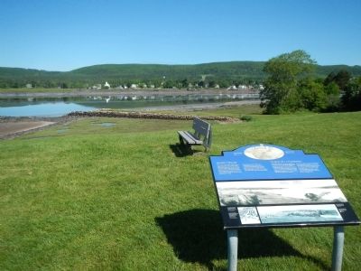
(Horticulture & Forestry • Industry & Commerce • Man-Made Features • Politics) Includes location, directions, 4 photos, GPS coordinates, map.

Chapel of St. John

$
0
0
Germany, Bavaria, Kreis Schweinfurt, Gerolzhofen
Im Jahr 1497 als Friedhofskapelle erbaut, vermutlich auf den Fundamenten älteren Taufkirche. Das untere Gewölbe diente bis 1816 als Aufbewahrungsort für die exhumierten Gebeine. In oberen Gottesdienstraum stand der Riemenschneider-Altar. Heute Museum.

Geschichte für alle - historischer Verein in Gerolzhofen, e.V.
Dr. Ottmar Wolf – Kulturstiftung

Marker text translated into English:
Built in 1497 as a cemetery chapel, probably on the foundations of an older baptistry. The lower arched area was used until 1816 as an ossuary. In the upper worship area was the Riemenschneider-Altar. Today a museum.

History for All - the Gerolzhofen Historical Society
Dr. Ottmar Wolf Cultural Foundation

(Arts, Letters, Music • Churches, Etc.) Includes location, directions, 6 photos, GPS coordinates, map.
Viewing all 103859 articles
Browse latest View live


Latest Images