Quantcast
Channel: The Historical Marker Database - New Entries
Viewing all 103684 articles
Browse latest View live

The Little Red School House

$
0
0
Ohio, Mahoning County, Poland
Built in 1858
Originally Poland Center School
has been placed on the National Register of Historic Places by the United States Department of the Interior

(Notable Buildings) Includes location, directions, 4 photos, GPS coordinates, map.

Door Village School

$
0
0
Indiana, LaPorte County, near La Porte


1832 - First log school
1883 - Two story brick school for grades 1 - 8
1900 - Grades 9 - 11 added
1912 - Grades 9 - 11 discontinued
1948 - New one story school with 4            classrooms and gym
1955 - Four classrooms added
1963 - Grades 7 - 8 discontinued
1983 - School closed after 150 years
1988 - Building demolished
1991 - Scipio Township park established
           School memorial dedicated

(Education) Includes location, directions, 5 photos, GPS coordinates, map.

Before the Battle Monument

$
0
0
Vermont, Bennington County, Old Bennington
was built there was no circular road on this hill top. The original road from Williamstown, Mass. came through Pownal, Vt. to Bennington, and continued straight through the village, over this hill north towards Shaftsbury.

All of the buildings within the new circular road constructed around the Battle Monument were removed They included a carpenter shop, the Vermont Gazette Building (home of Vermont’s first newspaper), a book binder’s shop, a cabinet maker’s shop, a general store, the Cushman Tavern and several homes and barns.

The last building to be torn down was the State Arms Inn shown in this photograph, circa 1870. It was built in 1780 near this spot, and it had a ball room on the third floor.

(Landmarks) Includes location, directions, 1 photo, GPS coordinates, map.

Captain Samuel Robinson

$
0
0
Vermont, Bennington County, Old Bennington
Near this spot in 1761
Captain Samuel Robinson
the pioneer settler of Bennington, the first magistrate in what is now Vermont, and during his lifetime, the acknowledged leader of the settlers of the town

built his first log cabin.

Captain Robinson was born in 1705, at Cambridge, Mass. came to Bennington in 1761 after much service in the frontier wars. He was a the head of his company in the Battle of Lake George. He died in London, England, October 27, 1767, while on a mission to the king in the interests of the people of New Hampshire grants.

Erected by
his great great grandson
Samuel L. Robinson
as a tribute to the pioneers
and patriot, and his distinguished
sons, who rendered
great service to the state.
1923

(Colonial Era • Notable Persons) Includes location, directions, 2 photos, GPS coordinates, map.

Site of the Catamount Tavern - 1767

$
0
0
Vermont, Bennington County, Old Bennington
The Catamount Tavern, which was built in 1767, was originally named the Green Mountain Tavern. The Council of Safety and the “Green Mountain Boys” met here from 1767 to 1775. On May 9, 1775, Ethan Allen and 270 men, 40 whom were “Green Mountain Boys”, captured Fort Ticonderoga from the British.

The Catamount Tavern burned down in 1871.
The first Post Office was located south of the Catamount Tavern until the building was moved to East Bennington by several yoke of oxen.

(Industry & Commerce • War, US Revolutionary) Includes location, directions, 2 photos, GPS coordinates, map.

The Creamery

$
0
0
Pennsylvania, Centre County, University Park, State College
In 1892 offered America's first collegiate instruction in ice cream manufacture. A program that has helped to make Penn State an international center for research in frozen confections. The original Creamery Bldg (1889) housed the nation's earliest extension courses in dairy science. The creamery moved to Patterson Bldg (1904), Borland Lab (1932, expanded 1960), and the Food Science Bldg (2006) where it was renamed the Berkey Creamery in recognition of philanthropic support.

(Agriculture • Education) Includes location, directions, 4 photos, GPS coordinates, map.

Johann Matthäus Meyfart and/und Caspar Friedrich Lossius

$
0
0
Germany, Thuringia, Erfurt

Here lived the evangelical
clergymen and teachers
Johann Matthäus Meyfart
(1590 - 1642)
Caspar Friedrich Lossius
(1753 - 1817)
————————
Hier wohnte die ev.
Geistlichen und Pädagogen
Johann Matthäus Meyfart
(1590 - 1642)
Caspar Friedrich Lossius
(1753 - 1817)

(Churches, Etc. • Education • Man-Made Features) Includes location, directions, 2 photos, GPS coordinates, map.

Centre Furnace Mansion

$
0
0
Pennsylvania, Centre County, State College
Welcome to Centre Furnace Mansion - birthplace of Penn State University and home of Centre County Historical Society.

(Education • Industry & Commerce) Includes location, directions, 7 photos, GPS coordinates, map.

Paulskirchturm / Paul's Church Tower

$
0
0
Germany, Thuringia, Erfurt

Church founded before 1187
Church built 1465-1468
Tower restored 1737

Destruction of the nave
in the first half of the 18th century
through fire and demolition
————————
Gründung der Kirche vor 1187
1465-1468 Kirche erbaut
1737 Turm erneuert

Zerstörung des Kirchenschiffes
in der. 1. Hälfte des 18. Jh.
durch Brand und Abbruch

(Churches, Etc. • Man-Made Features) Includes location, directions, 3 photos, GPS coordinates, map.

Orangeburg World War I Monument

$
0
0
New York, Rockland County, Orangeburg
In Honor of the Men
Of Orangeburg, N.Y.
Who Served Their Country
1917 World War 1918
*Charles Krebs   *Benjamin Logatto
*Archie Engles Petro Antonio • Albert Aluise • John Buhler • Frank Edsall • Robert Edsall • James Havey • Clarence Keiser • Albert O. Krauser • Philip Krebs • Sylvia Logatto • James F. McCarthy • Edward J. Miller • Alfred Scott • Ichabod Scot • William B. Scott • Whitney D. Sherman • Elbert W. Sherman • Frank Stattner • Joseph Stattner • Stephen Vajda • Jane C. Elliott Y.M.C.A.

(War, World I) Includes location, directions, 3 photos, GPS coordinates, map.

Orangeburg World War II Memorial

$
0
0
New York, Rockland County, Orangeburg
In Lasting Tribute To Those
Who Made The Supreme Sacrifice
Louis Casazza   James E. Drake   Thomas Linek
In Honor Of Those Who Served Rev. William S. Ackerman • Rev. Francis J. Stauback • Rev. Lafayette W. Yarwood • George J. Adams • Andrew Aitchison • Francis Armstrong • Anthony Amadio • John H. Barnum, Jr. • Bert Bedard • Edgar W. Blakeney • George Buhler • Edward J. Bullwinkle, Jr. • John Buseck • Angelo Cassetta • Joseph Casetta • Michael Casetta • James P. Celetano • John J. Celetano • George J. Celetano • William T. Chamberlain • Edward T. Chamberlain • Ronald F. Chamberlain • Clarence A. Chamberlain, Jr. • Vincent P. Chamberlain • Frank A. Chambrovic • John Chambrovic • Charles F. Craft • George Craft • William Craft • James Cuff • Arthur Deleu • Rena Derfuss • Richard Derfuss, M.M. • Joseph Dodge • Roy D. Drake • Peter D. Duhrendahl • Robert J. Eigo, Jr. • George E. Etzel • Joseph A. Etzel • Paul V. Etzel • Thomas Fenton • John Ferrogari • Paul Gold • Malcolm Hawkins • A. George Herrfurth • Frederick P. Hoffman • Thomas Hunter • Joseph Jankovio • Albert L. Johnson • Clarence E. Johnson • George G. Johnson • Raymond Johnson • Clarence Kaiser, M.M. • Edward Kant • Sidney Kant • Richard Kayns • Harry Keene • Karl F. Kirchner • William Krausser, Jr. • John A. Lick • Joseph Mack • Eugene J. Martin • Charles G. Martin • Clarence F. Martin • Kenneth R. Martin • Kenneth D. McGaha • John J. McKeon • Augustus Mundt • Victor Nedelka • Edward Noonan • John O’Neil • Henry Ostrom • Walter Ostrom • George L. Parsels • John Porcello • Harvey J. Scott • Morris E. Scott • Frederick T. Scott • Ichabod Scott, Jr. • A. Lester Scott • William B. Scott, Jr. • Vincent P.Scott • Vincent P. Scott • Raymond J. Scott • Edward W. Scott • Harvey Scott • George Shields • Thomas Shortall • Robert Shortall • Anthony Simon • Arnold D. Smith • Arthur Somers • Bernard Stanley • Stanley Stanley • Anthony Toriglio • Irving Ward

(War, World II) Includes location, directions, 3 photos, GPS coordinates, map.

Quaker Cemetery

$
0
0
Indiana, LaPorte County, La Porte
Near here settled pioneer Quakers, including the Aaron Stanton Family. In 1836 William Bond agreed to convey the Society of Friends three acres of land for a meeting house lot and burial ground. Bond died in 1837 and in 1841 the La Porte Circuit Court so ordered. Some 400 persons are said to have been buried, many with only a field stone marker.
— The Quaker Custom —

(Cemeteries & Burial Sites • Churches, Etc.) Includes location, directions, 6 photos, GPS coordinates, map.

Gates Homestead

$
0
0
Minnesota, Kandiyohi County, near Spicer
Joshua H. Gates arrived at Diamond Lake in 1857 where he claimed land in Sections 17 and 20 of Harrison Township. Gates may have been the first farmer in what is now Kandiyohi County. This is the site of the Joshua and Lucinda Gates family homestead. Born in Scholiarie, New York on August 4, 1824 where he studied to become a teacher. Gates married Lucinda Saper in 1846 in New York and had six children. Gates organized, built and taught his own school for the children of the Diamond Lake settlement, as early as 1859. He taught 20 terms and served as superintendent in both Monongalia County and later in Kandiyohi County. He served as county commissioner and the first county auditor.

This project has been financed in part with funds provided by
the State of Minnesota through the Minnesota Historical Society from the Arts and
Cultural Heritage Fund and the Kandiyohi County Historical Society.


(Settlements & Settlers) Includes location, directions, 4 photos, GPS coordinates, map.

Predigerkirche / Preachers' Church

$
0
0
Germany, Thuringia, Erfurt

Constructed about 1270
Gothic building completed in 1488
Former abbey of
the Dominican Order
with major parts dating
to the Middle Ages
Work Supervisor Eckhart
(*1260 †1328)
Evangelical since 1525
————————
Um 1270 Baubeginn
1488 gotischer Bau vollendet
Ehem. Klosterkirche
des Dominikanerordens mit
bedeutenden Ausstattungsstücken
des Mittelalters
Wirkungsstätte Meister Eckharts
(* um 1260 †1328)
seit 1525 evangelisch

(Churches, Etc. • Education • Man-Made Features) Includes location, directions, 15 photos, GPS coordinates, map.

Civil War Memorial

$
0
0
Kansas, Harvey County, Halstead

Dedicated
to the Soldiers
who so bravely offered
their all to preserve
the Union of States,
1861 to 1865

Decorated
in memory of our comrades
who sleep in the
Unknown,
peacefully awaiting the
call to the Parade Ground
of Heaven

Sleep Soldier,
though many regret thee,
Who stand by thy lone grave today.
Sleep, Sleep, -
though the kindest forget thee.
And thy name from
the earth pass away.

Erected by People
of this vicinity
under the auspices of
Buford Post No. 189 G.A.R.
Halstead, Kansas

[Around base of monument]
Our Flag • Country • Homes • Comrades

(Cemeteries & Burial Sites • Fraternal or Sororal Organizations • Patriots & Patriotism • War, US Civil) Includes location, directions, 10 photos, GPS coordinates, map.

Virginia

$
0
0
Pennsylvania, Delaware County, near King of Prussia
This marker is placed at the encampment site of regiments of the Commonwealth of Virginia to commemorate the officers and men of Virginia which area, at that time, encompassed what is now the state of West Virginia. These Virginians were wintered here in 1777-1778 as a part of General George Washington's army in the War for American Independence.

Includes location, directions, 2 photos, GPS coordinates, map.

American Icon

$
0
0
Pennsylvania, Montgomery County, King of Prussia
Americans of the Revolutionary era looked to ancient Rome and Greece as models of republican ideals. This statue, a bronze copy of die original marble which has stood in the rotunda of the Virginia State capitol since 1796, includes both classical and also American symbols that would have been familiar to Americans of die time. George Washington is depicted as a modern Cincinnatus, the Roman farmer and general who left his farm to save the Roman Republic, and then voluntarily returned to his plow. To study his subject, French sculptor Jean-Antoine Houdon traveled to America and stayed at Mount Vernon for two weeks, taking detailed measurements of Washington and casting this life mask. Washington’s family believed that the final statue was the most realistic depiction ever made of him.

Take a Closer Look

The Father of our Country wears his military uniform but carries a civilian walking cane rather than his sword, which has been set aside. He stands by a farmer's plowshare, a symbol of his love of peace and agriculture. He rests his hand on a bundle of rods called fasces, a Roman symbol of civil authority. Here, the thirteen rods represent the joining of the original states and the strength gained from that unity.

(caption)
George Washington, cast by Devile from original life mask by Houdon, 1785. Courtesy of the Mount Vernon Ladies’ Association.

(Patriots & Patriotism • War, US Revolutionary) Includes location, directions, 3 photos, GPS coordinates, map.

Why Valley Forge?

$
0
0
Pennsylvania, Montgomery County, King of Prussia

Location Matters

Just 20 miles outside Philadelphia, Valley Forge was close enough to monitor British army activities but far enough away to prevent a surprise attack. Washington used this hilly country to his advantage, building defensive lines on the ridges overlooking Philadelphia to the east and nestling the camp against the Schuylkill River to prevent attack from the north. From here he also could protect the outlying regions, including York, where the Continental Congress had fled. The area had abundant fresh water, trees for shelter and firewood, and food and forage from local farms.

(caption)
Military Action Leading to Valley Forge

After landing at the Head of Elk on the Chesapeake Bay, the British army marched north to capture the American capital, Philadelphia. Although the Continental Army tried valiantly to save the city, their losses at Brandywine and Germantown sealed the city's fate. The move to Valley Forge prevented the British from making any inroads into Pennsylvania’s interior, still heavy with supplies.

National Park Service, Harpers Ferry Center.

(War, US Revolutionary) Includes location, directions, 2 photos, GPS coordinates, map.

Washington’s Headquarters

$
0
0
Pennsylvania, Montgomery County, King of Prussia

”We had engaged in the defense of our injured country and we were determined to persevere.”
Private Joseph Plumb Martin

Valley Forge: An American Symbol

Welcome to Washington’s Headquarters, site of General Washington's command post and living quarters during the winter encampment of 1777-78.

The War of American Independence was in the third year of an eight and one-half year struggle when the Continental Army established its winter camp across thousands of acres here. The six-month Valley Forge Encampment was a defining moment in American history not because a great battle was fought here, but because of the extreme hardship endured during that winter and the national resolve that emerged from the experience. These came to symbolize the American spirit and the fight for freedom and self-governance.

Commemorating Valley Forge

Inspired by the 1876 centennial celebration in Philadelphia, citizens resolved that on June 19, 1878 there would be parades, music, and orations to honor the day the Continental Army proudly marched out of Valley Forge. The Valley Forge Centennial Association committed the proceeds from the event toward purchase of Washington’s Headquarters and its preservation for all to see.

What you see here today looks very different from the 1777 scene. Long gone are the original industrial village and the wooden huts and the fortifications that defined the camp. Since late in the 19th century, the memory of Valley Forge has been kept alive through creation of a commemorative park setting and preservation of key structures.

(War, US Revolutionary) Includes location, directions, 3 photos, GPS coordinates, map.

North of the River

$
0
0
Pennsylvania, Montgomery County, King of Prussia

The land just across the Schuylkill River played a vital role in the winter encampment. Provisions and armaments from throughout the region were brought there, and the army built a bridge for access across the river just downstream of this point. The commissary and a hospital were established there, and a farmers’ market was set up to sell goods and food to the soldiers. From that side of the river, the army could better monitor British movements to the north and east. When the camp on this side of the river became too foul General Washington ordered the army to move to the north side.

After the Revolution, the area flourished with the introduction of new scientific farming methods. Crop rotation, liming of fields, manure application, and cultivation of soil-improving crops transformed the region from small farming to commercial agriculture. The Schuylkill Navigation Canal, the Reading Railroad below you, and the Pennsylvania Railroad on the north side brought a vital connection to markets in the burgeoning city of Philadelphia.

(captions)
(lower left) After nearly six month’s occupation, the army’s encampment became increasingly unhealthy as hot weather came on. On June 9, Washington ordered the army to move out of their huts to fresh campgrounds with “good air and good water.” While most of the army camped in front of the old encampment. Sergeant Jeremiah Greenman from Rhode Island wrote that on June 10 “at the beat of the Genl. struck our tents. marcht about a mild over Schoolkills River & Piched our tents in a field in providance town Ship.” Archibald Robertson Maps, The New York Public Library.
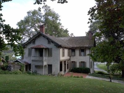
(upper right) This 19th century painting of the Pawling Farm was made at a point just east of here and shows what a successful enterprise it was. Fertile meadows stretched from the barn (still standing) and house (now a ruin) to the Schuylkill River.

(War, US Revolutionary) Includes location, directions, 2 photos, GPS coordinates, map.
Viewing all 103684 articles
Browse latest View live


Latest Images