Quantcast
Channel: The Historical Marker Database - New Entries
Viewing all 103834 articles
Browse latest View live

Newmarket Street

$
0
0
United Kingdom, Northern Ireland, County Londonderry, Derry-Londonderry


You are standing on the city walls. Newmarket Street slopes up and over the wall. The street was created in the mid 19th century on the site of the Smithfield Meat Market to allow carts to the new covered market.

(Forts, Castles • Industry & Commerce • Man-Made Features • Roads & Vehicles) Includes location, directions, 2 photos, GPS coordinates, map.

Ferryquay Gate

$
0
0
United Kingdom, Northern Ireland, County Londonderry, Derry-Londonderry


This gate was built in 1865 on the site of one of the four original entrances to the city. Like Bishop's Gate it had a drawbridge, which could be pulled up in times of troubles, to allow people to cross the dry moat. This was the gate that the Apprentice Boys locked in December, 1688. The carved heads are of Governor George Walker and Rev James Gordon who urged the citizens to refuse to admit James II's troops.

(Disasters • Forts, Castles • Man-Made Features • Settlements & Settlers) Includes location, directions, 2 photos, GPS coordinates, map.

Marion County / Wetzel County

$
0
0
West Virginia, Marion County, near Metz
Marion County
Side A
Formed, 1842, from Harrison and Monongalia. Named for hero of the Revolution, Gen. Francis Marion. County was home of Francis H. Pierpont, leader in formation of this State. The Monongahela River forms just above Fairmont.
Wetzel County
Side B
Formed in 1846 from Tyler. Named for Lewis Wetzel, the great frontiersman, who with his brothers during Indian days, ranged the settlements from their home in Marshall County throughout northern West Virginia.

(Settlements & Settlers • War, US Revolutionary • Waterways & Vessels) Includes location, directions, 4 photos, GPS coordinates, map.

Gold Mountain

$
0
0
California, San Francisco City and County, San Francisco
As dreams and the spirit of adventure lured “fortune-hunters” from many parts of the world to California during the mid 1800s, so the news spread to the far reaches of China. To the Chinese, California came to symbolize an image of salvation, hope and prosperity – “Gum Saan” – Gold Mountain. Struck by natural disasters, political turmoil and forced colonization, China had become a country transformed from a land of cultural wealth to a land devastated by war, political oppression and famine. With little choice, many packed what modest belongings they had, boarded the sailing vessels and embarked on an uncertain, perilous voyage bound for “Gum Saan”.

Although not all Chinese who traveled to San Francisco between 1850 and 1915 stayed permanently, approximately 150,000 made the Bay Area their home. Despite disappointments during the Gold Rush and unconstitutional United States laws, the Chinese made vast contributions to the Pacific railroad, shipping and fishing industries, reclamation of the tule swamplands in the Sacramento and San Joaquin Valleys and construction in the Napa Valley Vineyard region, among others. Locally, the Chinese in a short period of time started and owned most of the city’s laundries, slipper, shoe and boot industries, and many of its restaurants. Known as excellent sailors with experience in the rough waters of the China seas, it was quite natural for them to manufacture and maneuver their junks and sampans trough the California waters. It was not uncommon to see junks measuring up to 59 feet in length sailing side by side with European clipper ships in the Bay. As the shrimping industry flourished, the Chinese established fishing villages similar to those found on the coast of China, lining the Bay from Tamales Bay and Point San Pedro in Marin County to Monterey Bay. At the height of the shrimping industry in 1895, the shrimp catch was worth $162,749, about $40,000 more than California’s salmon catch. The surrounding beaches and hillsides were used to dry the shrimp catch, most of which then shipped to China on the San Francisco based Pacific Mail Steamship Line. Over time, the Chinese fishing communities suffered a decline for several reasons, among which were the anti-Chinese legislation and the pollution of the Bay and bay fill which destroyed the shrimp beds. From 1876 to 1916 the Chinese as seamen, were the backbone of the great movement of transpacific ocean lines. The Pacific Mail Steamship Company made its first transpacific run in 1867. Along with the Occidental & Oriental Steamship Company, their combined fleet of 27 vessels made more than 1,000 round trips between San Francisco and Hong Kong via Yokohama. Over the next 30 years the number of individual Chinese holding maritime positions was 78,433.

The Chinese characters for "Gum Saan", Gold Mountain, are found on the pedestal.

(Asian Americans) Includes location, directions, 3 photos, GPS coordinates, map.

Chief Little Crow

$
0
0
Minnesota, McLeod County, Hutchinson

He fought for the Indian's right
to live in peace in this land.
Gift · Mr. & Mrs. Les Kouba · 1982
Erected 1937 The red of the sunset upon these waters reminds us that all blood is red--even that of the red-skin who fought us for possession of this stream, and in the mist which rises from the river we see the smoke of the pipe of peace between all peoples curling upward from the valley of the Crow.

(Wars, US Indian) Includes location, directions, 5 photos, GPS coordinates, map.

The Walled City

$
0
0
United Kingdom, Northern Ireland, County Londonderry, Derry-Londonderry


If 'stones could speak', what a story they would have to tell. Their voices still echo on the walls and in the city streets.

According to tradition St. Colm Cille chose the oak grove on top of the hill for his monastery in 546 AD. His community became a beacon of light and learning throughout Europe. Around it grew a settlement with a stronghold, cathedral and port.

In 1610 the City of London Companies agreed to build a new city on the Foyle in return for land in King James I's new plantation. Their legacy is Ireland's most complete town walls with their 'roaring cannon' and the first post-Reformation cathedral in the British Isles. The accents of Planter and Gael still shape the city's culture and traditions.

The fertile banks of the Foyle have been disputed territory since prehistoric times. The city withstood two sieges, each of over a hundred days. In 1689 it was caught up in the struggle between James II and William III for the English throne. By the time the siege was reli[e]ved, the citizens were starving but their indomitable spirit remained unbroken.

In succeeding centuries the city prospered, expanding beyond the walls and across the river. Industries like shirt making and whisky distilling flourished while the port became a leading centre of international trade. From the 18th century many thousands of emigrants left from the quaysides to start a new life in North America. They transplanted their traditions to new territories. During the Second World War, convoys left the Foyle to help win the Battle of the Atlantic and sailors from many parts of the globe spent their shore leave in the city.

The city played its part in the civil rights movement of the 1960s and experienced its share of conflict and tragedy during the Troubles. By 1980 a third of the buildings within the walls had been damaged or destroyed. Yet the people's spirit was undefeated, expressed in a burst of creativity from poetry to punk.

With the return of peace, the city reinvented itself again as a regional city, University campus, a fusion of Irish and British culture and an international tourist destination.

The city is still making history today. Experience it.

(Disasters • Forts, Castles • Man-Made Features • Settlements & Settlers) Includes location, directions, 2 photos, GPS coordinates, map.

Water Bastion

$
0
0
United Kingdom, Northern Ireland, County Londonderry, Derry-Londonderry


Feabhail
The river Foyle lapped against the Water Bastion until the late 18th century. The name Foyle probably arose because English-speaking settlers had difficulty saying the Irish 'Feabhail', used traditionally to describe the stretch of water from the sea to Strabane. Some say that it took its name from the legendary chieftain Feabhail who was drowned by a giant wave. The truth is simpler. The word comes from the Welsh for a 'lip', describing the shape of the estuary.

Lundy's escape
Disgraced Governor Robert Lundy escaped over the wall near here during the 1689 siege. Suspected of plotting to surrender the city to James II, he was removed from office on 19th April. The next night the new Governors Henry Baker and George Walker helped Lundy, disguised as an ordinary soldier, to escape the fury of the crowd. He climbed through the branches of a pear tree growing against the wall before being ferried from Shipquay Gate to board a ship for Scotland. The name Orchard Street recalls the scene of his flight.

Smugglers Ahoy!
The quay of Derry is broad and convenient and vessels of 600 ton may float on it...The trade increases very much - but smuggling continues to thrive. In the late 1780s six companies of soldiers were brought in to pursue smugglers who, if caught, could face the death penalty. Less than half a century later convicted smugglers joined a new type of vessel at the quays - the convict ships bound for the penal colonies of Australia.

'Casbah Rock'
Five young men put the city on the punk map. The Undertones started out playing gigs at the Casbah bar on Foyle Street in 1976. Their debut single - 'Teenage Kicks' - so inspired legendary DJ John Peel that he declared it to be his favourite record of all time. Four albums and thirteen singles later, the band split in 1983. The Undertones have since come together again with a new vocalist. Their first appearance celebrated the opening of the Nerve Centre, the city's multimedia arts base in 2001.

(Entertainment • Forts, Castles • Man-Made Features • Settlements & Settlers) Includes location, directions, 3 photos, GPS coordinates, map.

Shipquay Gate

$
0
0
United Kingdom, Northern Ireland, County Londonderry, Derry-Londonderry


'A city fit for war and merchandise'
In 1600 Elizabeth I of England instructed Sir Henry Docwra to establish and fortify a new settlement on the Foyle. An explosion in the cathedral in 1567 had largely destroyed the town. Docwra and his 4200 troops re-used the stones and rubbish of the old buildings. He surrounded the main fort with earthen walls to protect it from attack by powerful local chiefs.

Plantation city
The Plantation city was the first planned town in Ireland. The merchant companies of the City of London funded its building in return for grants of land in the North of Ireland. Four streets met in a central market area called the Diamond. Walls and ditches surrounded the settlement and a gate on each side controlled who went in and out. By 1620 the town had around 100 houses, a church and a school.

'Excellently made and neatly wrought'
Built between 1614-18 the walls are among the finest fortifications of their kind in Europe. They are over 1.5 km long and up to eight metres high: in places they are over nine metres wide. Originally there were four gates in the walls, two of which had drawbridges. Except along the steep slope overlooking the bog, a dry ditch, 3.5 metre deep, was dug outside the walls for added protection.

Abbey Street to Workhouse Lane
Street names are a reminder of the city's past. Vessels tied up at the foot of Shipquay Street until the late 18th century. A small boat took passengers across the river from the Ferryquay or Wapping. It became Bridge Street after the first crossing of the Foyle opened in 1781. Some names changed several times over the years - Ferryquay Street has also been known as Gracechurch Street, Gracious Street and Queen Street.

(Forts, Castles • Man-Made Features • Settlements & Settlers • Waterways & Vessels) Includes location, directions, 2 photos, GPS coordinates, map.

Arthur Joyce Lunel Cary

$
0
0
United Kingdom, Northern Ireland, County Londonderry, Derry-Londonderry


Novelist
was born here

(Arts, Letters, Music • Entertainment • Man-Made Features) Includes location, directions, 2 photos, GPS coordinates, map.

Demi-culverin Cannon

$
0
0
United Kingdom, Northern Ireland, County Londonderry, Derry-Londonderry


Demi-culverin with
Rose and Crown (C12)
Bore 4.5", Length 120"
Weight 3417lb
Cast in 1590 by Thomas Johnston
Founder of iron ordnance to
Queen Elizabeth I

(Forts, Castles • Man-Made Features) Includes location, directions, 3 photos, GPS coordinates, map.

Day Street Baptist Church

$
0
0
Alabama, Montgomery County, Montgomery
Organized from Bethel Baptist Church, congregation founded 1882 with Rev. George Casby as first minister. Originally met in frame building; fund-raising began for this edifice in 1906. Designed by Wallace Rayfield, Tuskegee Institute architect and faculty member, building completed ca. 1910. A graduate of Pratt School of Architecture, Rayfield established the first black architectural firm in Birmingham and won national recognition. Day Street's community activities included the organization of the first black Alabama scout troops and involvement in the Civil Rights Movement. Rev. M. C. Cleveland led the church from 1933 until his death in 1978.

(African Americans • Churches, Etc. • Civil Rights) Includes location, directions, 2 photos, GPS coordinates, map.

Loveless School/Henry Allen Loveless

$
0
0
Alabama, Montgomery County, Montgomery
(side 1) Loveless School
Montgomery's first junior and senior high schools for African American students began in Loveless School. Built in 1923 and enlarged in 1930, this building first housed seven grades; the opening of Carver Elementary School and the reduction in enrollment made possible additional classes at Loveless. Under Principal T.H. Randall, the first seniors graduated in May, 1940. In 1948, George Washington Carver Senior High organized and had first classes here, but upon its moving to new quarters, Loveless reverted to a junior high and then to elementary. In spring of 1998, elementary moved to new site, and in fall of 1999, Loveless became home of LAMP.

(side 2) Henry Allen Loveless
Born in Bullock County in 1854, H.A. Loveless struggled to get an education, working by day and attending school at night. After a few terms at Selma University, he settled in Montgomery where he first entered the undertaking profession. In addition, he opened a coal and wood yard, operated a livery stable and was a building contractor. A founding member of Dexter Avenue Baptist Church, he served as treasurer and was on its Board of Trustees and that of Swayne School. An officer of the Alabama Realty Company, he was also a member of the Negro Businessmen's League and numerous fraternal organizations. He died in 1921, respected by the entire community.

(African Americans • Education) Includes location, directions, 3 photos, GPS coordinates, map.

A Minority in Their Homeland / U.S.-Dakota Conflict

$
0
0
Minnesota, Nicollet County, near Fairfax
A Minority in Their Homeland For generations, the land stretching out around you was the homeland of the Dakota Indians. Through treaties in 1851, the Dakota sold all of their land in southern Minnesota. The treaties disregarded Dakota people's traditional decision-making processes and were written in a language they hardly knew. Making an "X" on a piece of paper was not the same as the Dakota way of taking council and obtaining the majority's consent.

After the signings, the Dakota were coerced onto reservations on the Minnesota River—but only until that land, too, was needed for white settlement. By 1860, white settlers in the Minnesota River Valley outnumbered the Dakota five to one. In a single decade, the Dakota people had become a minority in their homeland.

U.S.-Dakota Conflict "We went down determined to take the fort," said Wambdi Tanka (Big Eagle). "If we could take it we would soon have the whole Minnesota valley."

One of the bloodiest U.S.-Indian wars was fought along the Minnesota River, from Upper Sioux Agency to New Ulm. Here at Fort Ridgely, soldiers and Dakota warriors battled for two days.

By the summer of 1862, Dakota families were on the verge of starvation. They had been waiting months for food promised them in government treaties. Tensions exploded on August 16, 1862, when Dakota leaders confronted Lower Sioux Agency trader Andrew Myrick demanding the food they had been promised. Myrick reportedly said they should "eat grass if they are hungry." Furious Dakota warriors attacked the agencies, towns, and settlers in the region. Myrick was one of the first to be killed, and his mouth was stuffed with grass.

The violence lasted more than a month. About 500 settlers and 80 soldiers were killed. Many Dakota were also killed, and hundreds died in the aftermath. Hundreds more were rounded up and incarcerated at Fort Snelling where at least 130 died, most of them children. All treaties were voided, and the Dakota people were exiled from the state. After a trial, 38 Dakota men were hanged in Mankato on December 26, 1862—the largest mass execution in U.S. history.

Minnesota Historical Society
Fort Ridgely


(Native Americans • Wars, US Indian) Includes location, directions, 5 photos, GPS coordinates, map.

Sherman W. White, Jr.

$
0
0
Alabama, Montgomery County, Montgomery
Side 1:
Sherman, Sr. and Nettie White lived at this address on W. Jeff Davis Ave. Both teachers, they taught their children Sherman Jr., Willa, James, and Samson to love their country and value education. Willa, James, and Samson would graduate from college. Sherman, Jr. left school at the U. of Chicago to enlist as an Army Air Forces aviation cadet at Tuskegee, Alabama. At Tuskegee were trained the first African-American military aviators in the history of the U.S. Armed Forces. In the third class at Tuskegee, White graduated in May 1942 as a 2d. lieutenant, allowing him to make the payments on his parents' house. (Continued on other side)
Side 2:
(Continued from other side) White joined the 99th Fighter Squadron at Tuskegee, the U.S. Armed Forces' first all-black tactical air unit. Willa (WAC) and James White (QM Corps) served in the Army in WW II. Samson later was in the Army in the Korean War. Lt. Sherman White and the 99th moved to North Africa for combat. On July 2, 1943, escorting bombers over the Mediterranean, 99th P-40 fighters intercepted attacking German fighters. While protecting the bombers, the 99th had two of its P-40s shot down into the sea. White was one of the U.S. Armed Forces' first two black aviators killed in action.

(African Americans • Air & Space • War, Korean • War, World II) Includes location, directions, 3 photos, GPS coordinates, map.

Holt Street Baptist Church

$
0
0
Alabama, Montgomery County, Montgomery
Congregation founded by former members of Bethel Baptist Church in 1909. Under leadership of Rev. I.S. Fountain, group met for four years in Labor's Hall, corner of Cobb and Mobile Streets, before purchasing this site and constructing church in 1913. Congregation added wing 1946, and in 1953 demolished old structure and built present sanctuary. On evening of December 5, 1955, the first day of Bus Boycott, some 5,000 people gathered here. Dr. Martin Luther King, newly elected leader of Montgomery Improvement Association, addressed the crowd which pledged support for continuation of boycott. Minister, A.W. Wilson, was officer of MIA.

(African Americans • Churches, Etc. • Civil Rights) Includes location, directions, 4 photos, GPS coordinates, map.

Demi-culverin Cannon

$
0
0
United Kingdom, Northern Ireland, County Londonderry, Derry-Londonderry


John Browne No.1
Demi-culverin (C8)
Bore 4.7", Length 98"
Weight 3117lb
Cast by John Browne possibly at
Horsmonden, Kent 1615-1625

(Forts, Castles • Man-Made Features) Includes location, directions, 2 photos, GPS coordinates, map.

Percy Lavon Julian

$
0
0
Alabama, Montgomery County, Montgomery
Born on the west side of Holt Street, April 11, 1899, Percy Lavon Julian entered Depauw University in 1916; graduated in chemistry with Phi Beta Kappa honors. Earned master's from Harvard, Ph.D. at the University of Vienna. His studies led to a synthetic drug for glaucoma. Experiments with soybean oils resulted in Compound S, an affordable synthetic form of cortisone for arthritis treatment. Julian's work included developments in production of artificial hormones and a foam for fighting fires onboard ships. Dedicated to relieving human suffering, he held over 130 patents at his death in April 1975. The U.S. issued a postage stamp in his honor in 1992.

(African Americans • Science & Medicine) Includes location, directions, 3 photos, GPS coordinates, map.

Lilly Baptist Church

$
0
0
Alabama, Montgomery County, Montgomery
Lilly Baptist Church, established November, 1900 as a missionary church of Bethel Missionary Baptist. Originally located on St. Clair Street in a small frame building. Moved May 27, 1973, into new 1500-seat sanctuary at present location. Education Complex added April, 1985. Known as "The Lilly," church was active in Montgomery Bus Boycott (1955-56). Noted for its music, the church has seven choirs which recorded albums in 1974 and 1984. 500 members of congregation participated in nationally acclaimed movie, "Long Walk Home." "The Lilly" has played a significant role in Montgomery since its founding and continues to serve as a spiritual beacon to the community.

(African Americans • Arts, Letters, Music • Churches, Etc. • Civil Rights) Includes location, directions, 2 photos, GPS coordinates, map.

Bethel Missionary Baptist Church

$
0
0
Alabama, Montgomery County, Montgomery
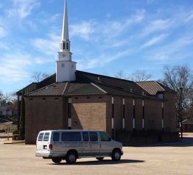
Organized in 1967 as the Second Colored Baptist Church, congregation later changed named to Bethel Missionary Baptist. First building burned in 1908. Rev. E.W. Pickett then conducted services in "Love and Charity Hall" until second structure built in 1912 in same neighborhood but different site. In 1943, church remodeled under leadership of Rev. H.H. Hubbard. During the ministry of Rev. Edward Martin, the members, having outgrown the old building, built present edifice. Congregation has taken active role in social ministry, contributing to the well-being of the community. Cornerstone reflects its philosophy: "Home of Amazing Grace and Headquarters of the Holy Ghost."

(African Americans • Churches, Etc.) Includes location, directions, 2 photos, GPS coordinates, map.

City of St. Jude/The Selma to Montgomery March

$
0
0
Alabama, Montgomery County, Montgomery
(side 1) City of St. Jude
Founded by Father Harold Purcell in the 1930s, the City of St. Jude included church, school, medical facilities, social center and rectory. Its mission was to provide spiritual, educational, social and health services for Montgomery's black citizens. Distinguished for its Romanesque architecture and landscaping, site was designed by architects William Calham and Joseph Maschi. Leading the way in nondiscriminatory health care, the institution helped organize the county's first prenatal care program, school of practical nursing and first drug and alcohol treatment center in the state. In 1953 it provided primary polio treatment. Hospital closed, 1985; church and school continue to serve the community in the spirit as that of its founder.

(side 2) The Selma to Montgomery March They Camped Here
On March 24, 1965, more than 25,000 weary marchers, seeking voter rights, rested on these grounds. Joining them were Harry Belafonte, Sammy Davis, Jr., Leonard Bernstein, Mahalia Jackson, Shelly Winters and other supporters. As no public facilities were available to them, Father Paul J. Mullaney, director, City of St. Jude, opened parish grounds to crowd where they rested under protection of St. Jude Thaddeus, patron saint of hopeless cases and champion of impossible causes. The next morning marchers continued on to state capitol to further cause of voter registration.

(African Americans • Churches, Etc. • Civil Rights • Education • Science & Medicine) Includes location, directions, 5 photos, GPS coordinates, map.
Viewing all 103834 articles
Browse latest View live


Latest Images