Alabama, Lee County, Auburn
![]() Wittel Dormitory has long been admired as one of Auburn’s most significant examples of classic nineteenth-century design. Built in the early 1900’s by Samuel S. Wittel to house professional women, it also served as a home for three generations of the Wittel family. After World War II enrollment at the Polytechnic Institute, which is now Auburn University, rose dramatically and Wittel became Auburn’s first dormitory for college women. The original structure features copper roof details, wood floors throughout, silver plate applied to the front entrance ceilings and Auburn’s first elevator.
Wittel Dormitory has long been admired as one of Auburn’s most significant examples of classic nineteenth-century design. Built in the early 1900’s by Samuel S. Wittel to house professional women, it also served as a home for three generations of the Wittel family. After World War II enrollment at the Polytechnic Institute, which is now Auburn University, rose dramatically and Wittel became Auburn’s first dormitory for college women. The original structure features copper roof details, wood floors throughout, silver plate applied to the front entrance ceilings and Auburn’s first elevator.
(Education) Includes location, directions, 2 photos, GPS coordinates, map.
 Wittel Dormitory has long been admired as one of Auburn’s most significant examples of classic nineteenth-century design. Built in the early 1900’s by Samuel S. Wittel to house professional women, it also served as a home for three generations of the Wittel family. After World War II enrollment at the Polytechnic Institute, which is now Auburn University, rose dramatically and Wittel became Auburn’s first dormitory for college women. The original structure features copper roof details, wood floors throughout, silver plate applied to the front entrance ceilings and Auburn’s first elevator.
(Education) Includes location, directions, 2 photos, GPS coordinates, map.
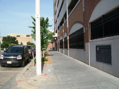
 The Alpha Mu chapter of Sigma Alpha Epsilon was founded on June 15, 1878 at the Agricultural & Mechanical College of Alabama (now Auburn University). John E.D. Shipp came to Auburn as a student determined to organize a chapter at a time when fraternities were forbidden on campus. Working in secrecy with SAE brothers in Georgia, Shipp had two members of Mercer University's chapter, William H. Felton and Frank H. Greaves, travel to Auburn to install the chapter behind Old Main in a cornfield where Samford Hall now stands. The first fraternity on Auburn's campus, Sigma Alpha Epsilon remains a place for "The True Gentleman."


 W. 1/2 mi. Now Confederate Park. Here, Oct. 5, 1862, during Battle of Corinth, occurred a C.S.A. charge as heedless of cost as those of Pickett at Gettysburg and Light Brigade at Balaclava.
 The Moss House, one of Corinth's popular hotels, stood across this intersection. When the Union army occupied Corinth in 1862, the Provost Marshal established headquarters in the building. Army officers who served as provost marshal had the responsibility for policing and maintaining order among both military and civilian occupants of the town.
 Over the years most of Logan Circle's Mansions experienced numerous uses and have returned to private occupancy. For example 15 Logan Circle was completed in 1877 for Lt. Cmdr. Seth Ledyard Phelps, a Civil War Veteran appointed by President Ulysses S. Grant to the Board of Commissioners (the body that governed DC from 1874 until 1967). In 1891 the Kingdom of Korea (Joseon Dynasty) purchased number 15 for its first embassy in the United States. Just before Imperial Japan annexed Korea in 1910, the Japanese government forcibly took possession of the house and sold it. Eventually the mansion house a World War II-era recreation center for African Americans and then offices for locals 639 and 730 of the International Brotherhood of Teamsters before returning to a series of private owners. The Korean government repurchased the house in 2012, marking the 130th anniversary of U.S. Korea diplomatic relations. Phelps also built the adjoining 1502 3th Street, briefly the clubhouse of African American journalists, then a rooming house of ill repute known as the Raleigh, and, since the 1990s, condominium apartments.
  Site of an Indian Village
 Constructed in 1832 under the leadership of the Reverend Samuel Simon Schmucker, the brick federal-style building was an impressive home for the Lutheran Theological Seminary at Gettysburg. In July 1863, as war engulfed Gettysburg, the building became a military observation post, a strategic artillery position and a field hospital that cared for more than 600 of the wounded.
  Near this spot A.D. 1805 stood the first law office of Daniel Webster the great interpreter of the American Constitution. One of the world's great orators. "Liberty and Union, one and inseparable, now and forever."
 Built About 1781 By