September 3, 2017, 6:09 pm
near Madera, Pennsylvania.![]()
On July 1, 1784 Revolutionary War Soldier James Alexander (1726-1791) received a warrant for this ground. In 1809 his son William Brown Alexander (1782-1862) settled here, and the area became known as Alexander's Fording. . . .
(Cemeteries & Burial Sites • War, US Revolutionary) Includes complete text, location, directions, 3 photos, GPS coordinates, map.
↧
↧
September 3, 2017, 6:45 pm
Yarmouth, Nova Scotia.![]()
Executive Director Yarmouth Waterfront Development Corporation It is with great pleasure that the Yarmouth Waterfront Development Corporation dedicates this trail to the memory of Robert E. Hartlin. The "Hartlin Trail" . . .
(Notable Persons) Includes complete text, location, directions, 3 photos, GPS coordinates, map.
↧
September 3, 2017, 6:55 pm
Madera, Pennsylvania.![]()
On July 1, 1784 Revolutionary War Soldier James Alexander (1726-1791) received a warrant for 413 acres in Clearfield County. James served with Washington at Valley Forge during winter of 1777-78. In 1785 James and son Robert . . .
(Settlements & Settlers • War, US Revolutionary) Includes complete text, location, directions, 2 photos, GPS coordinates, map.
↧
September 3, 2017, 7:13 pm
Olanta, Pennsylvania.![]()
On December 13, 1864, Co. C 16th VRC of the Union Army surrounded the Barnett log house at this site and requested the surrender of deserters and draft dodgers. Deserter Tom Adams fired and killed Union Soldier Edgar Reed of . . .
(War, US Civil) Includes complete text, location, directions, 4 photos, GPS coordinates, map.
↧
September 3, 2017, 7:26 pm
Pearlington, Mississippi.![]()
The SOC-R is designed as a high speed boat with ample weapons and equipment capacity. Its primary mission is insertion/extraction of SEALs into a low-to-medium threat environment in a riverine area. Secondary missions . . .
(Military • Waterways & Vessels) Includes complete text, location, directions, 3 photos, GPS coordinates, map.
↧
↧
September 3, 2017, 7:33 pm
near Olanta, Pennsylvania.![]()
The county draft roll of August of 1864 had over 500 names, and only 150 men answered the call. In June 1863 assistant marshal David Cathcart was shot in Knox Twp. by draft dodgers working as loggers. Homes were set fire in . . .
(Notable Events • War, US Civil) Includes complete text, location, directions, 3 photos, GPS coordinates, map.
↧
September 3, 2017, 7:44 pm
Franklin, Louisiana.![]()
Part of the Union advance through La. was known as the Teche Campaign. Union troops of the 4th Division XIX Army Corps tried to halt supplies for Confederate troops coming from Texas. On this site on April 14, 1863 . . .
(War, US Civil) Includes complete text, location, directions, 2 photos, GPS coordinates, map.
↧
September 3, 2017, 7:46 pm
Richmond, Virginia.![]()
Here stood the Friends Asylum. for Colored Orphans. Lucy Goode Brooks and the Ladies Sewing Circle for Charitable Work, all formerly enslaved, founded it in 1871. The orphanage, supported by the Cedar Creek Meeting Society . . .
(African Americans • Charity & Public Work • Landmarks) Includes complete text, location, directions, 2 photos, GPS coordinates, map.
↧
September 3, 2017, 7:47 pm
New Millport, Pennsylvania.![]()
From 1979-1985, Harry Matlack discovered 126 Late Woodland Indian graves with encampments dating from 1500 to 1650 at the old Grier Bell Farm near here. This site was a three-component village, home for at least three . . .
(Anthropology • Native Americans) Includes complete text, location, directions, 2 photos, GPS coordinates, map.
↧
↧
September 3, 2017, 7:55 pm
Curwensville, Pennsylvania.![]()
On March 13, 2004 an authentic timber raft 28 ft. x 110 ft. launched from this point for a 26-mile journey through the county to below Shawville. The raft, including a cabin, was built by over 100 volunteers using logs . . .
(Notable Events) Includes complete text, location, directions, 2 photos, GPS coordinates, map.
↧
September 3, 2017, 8:10 pm
Baton Rouge, Louisiana.![]()
In 1775, next to Bayou Manchac, Bartram Travelled a "road strait, spacious" and "under the shadow of a grand forest." In memory Of Fred G. Benton, Jr., Bartram Trail Supporter
(Colonial Era • Education • Horticulture & Forestry • Science & Medicine) Includes location, directions, 3 photos, GPS coordinates, map.
↧
September 3, 2017, 8:10 pm
near Clearfield, Pennsylvania.![]()
1968 - the Old Town Sportsman Association started trout stocking 1975 - the Old Town Sportsman Association started its annual fishing derby 1999 - the PA Fish and Boat Commission started stocking trout as part of its annual . . .
(Environment • Sports) Includes complete text, location, directions, 2 photos, GPS coordinates, map.
↧
September 3, 2017, 9:16 pm
Helena, Arkansas.![]()
Thousands of refugee slaves came with the Union army into Helena and they continued to come. Helena became an island of freedom in a slave state. The Union Army Recruits Freedmen In the spring of 1863, changes in federal . . .
(African Americans • Forts, Castles • War, US Civil) Includes complete text, location, directions, 3 photos, GPS coordinates, map.
↧
↧
September 3, 2017, 9:16 pm
Helena, Arkansas.![]()
The Union Army Takes Helena, July 1862 When General Samuel Curtis marched into Helena he was not sure if he would remain. But the city's location on the Mississippi River made it a valuable strategic resource that the Union . . .
(Forts, Castles • War, US Civil) Includes complete text, location, directions, 3 photos, GPS coordinates, map.
↧
September 3, 2017, 9:16 pm
Helena, Arkansas.![]()
The election of Abraham Lincoln in 1860 broke the nation apart. In May 1861, Arkansas became the ninth state to join the new Confederate States of America. The Union Army Occupies Helena By the spring of 1861, most of the . . .
(War, US Civil) Includes complete text, location, directions, 4 photos, GPS coordinates, map.
↧
September 3, 2017, 10:00 pm
St. Charles, Arkansas.![]()
Here on June 17, 1862 a Federal fleet of eight vessels attempted to force its way upstream past Confederate shore defenses commanded by Captain Joseph Fry. The Confederates disabled the Union gunboat Mound City with heavy . . .
(War, US Civil • Waterways & Vessels) Includes complete text, location, directions, 4 photos, GPS coordinates, map.
↧
September 4, 2017, 6:17 am
Opelousas, Louisiana.![]()
Built in the 1880s by Emar Andrepont, this building is typical of an old "general" country store. Originally built in the rural St. Landry Parish community of Prairie Ronde, the store operated for nearly 100 years. It was . . .
(Industry & Commerce • Settlements & Settlers) Includes complete text, location, directions, 2 photos, GPS coordinates, map.
↧
↧
September 4, 2017, 6:30 am
Opelousas, Louisiana.![]()
This small, single frame wood structure was built in 1948 as a house of worship for the African American Methodist congregation in the small, rural St. Landry Parish village of Palmetto. The church purchased a parcel of land . . .
(African Americans • Churches, Etc.) Includes complete text, location, directions, 2 photos, GPS coordinates, map.
↧
September 4, 2017, 6:44 am
Helena, Arkansas.![]()
Seasons change, as they do, birds and other wild animals migrate from one place to the next to find food. Many birds follow the twists and turns of the Mississippi River as they journey from the northern United States to . . .
(Animals • Environment • Waterways & Vessels) Includes complete text, location, directions, 2 photos, GPS coordinates, map.
↧
September 4, 2017, 6:51 am
Helena, Arkansas.![]()
The Delta represents a “melting pot” of diverse cultures. And most of them got here by canoe. Canoeing is the oldest form of water transportation on the Mississippi River-at least 2,000 years old! In the Quapaw tribal . . .
(Disasters • Exploration • Native Americans • War, US Civil) Includes complete text, location, directions, 2 photos, GPS coordinates, map.
↧
 On July 1, 1784 Revolutionary War Soldier James Alexander (1726-1791) received a warrant for this ground. In 1809 his son William Brown Alexander (1782-1862) settled here, and the area became known as Alexander's Fording. . . .
  Executive Director Yarmouth Waterfront Development Corporation It is with great pleasure that the Yarmouth Waterfront Development Corporation dedicates this trail to the memory of Robert E. Hartlin. The "Hartlin Trail" . . .
  On July 1, 1784 Revolutionary War Soldier James Alexander (1726-1791) received a warrant for 413 acres in Clearfield County. James served with Washington at Valley Forge during winter of 1777-78. In 1785 James and son Robert . . .
  On December 13, 1864, Co. C 16th VRC of the Union Army surrounded the Barnett log house at this site and requested the surrender of deserters and draft dodgers. Deserter Tom Adams fired and killed Union Soldier Edgar Reed of . . .
  The SOC-R is designed as a high speed boat with ample weapons and equipment capacity. Its primary mission is insertion/extraction of SEALs into a low-to-medium threat environment in a riverine area. Secondary missions . . .
  The county draft roll of August of 1864 had over 500 names, and only 150 men answered the call. In June 1863 assistant marshal David Cathcart was shot in Knox Twp. by draft dodgers working as loggers. Homes were set fire in . . .
  Part of the Union advance through La. was known as the Teche Campaign. Union troops of the 4th Division XIX Army Corps tried to halt supplies for Confederate troops coming from Texas. On this site on April 14, 1863 . . .
  Here stood the Friends Asylum. for Colored Orphans. Lucy Goode Brooks and the Ladies Sewing Circle for Charitable Work, all formerly enslaved, founded it in 1871. The orphanage, supported by the Cedar Creek Meeting Society . . .
  From 1979-1985, Harry Matlack discovered 126 Late Woodland Indian graves with encampments dating from 1500 to 1650 at the old Grier Bell Farm near here. This site was a three-component village, home for at least three . . .
  On March 13, 2004 an authentic timber raft 28 ft. x 110 ft. launched from this point for a 26-mile journey through the county to below Shawville. The raft, including a cabin, was built by over 100 volunteers using logs . . .
  In 1775, next to Bayou Manchac, Bartram Travelled a "road strait, spacious" and "under the shadow of a grand forest." In memory Of Fred G. Benton, Jr., Bartram Trail Supporter
 1968 - the Old Town Sportsman Association started trout stocking 1975 - the Old Town Sportsman Association started its annual fishing derby 1999 - the PA Fish and Boat Commission started stocking trout as part of its annual . . .
  Thousands of refugee slaves came with the Union army into Helena and they continued to come. Helena became an island of freedom in a slave state. The Union Army Recruits Freedmen In the spring of 1863, changes in federal . . .
  The Union Army Takes Helena, July 1862 When General Samuel Curtis marched into Helena he was not sure if he would remain. But the city's location on the Mississippi River made it a valuable strategic resource that the Union . . .
  The election of Abraham Lincoln in 1860 broke the nation apart. In May 1861, Arkansas became the ninth state to join the new Confederate States of America. The Union Army Occupies Helena By the spring of 1861, most of the . . .
  Here on June 17, 1862 a Federal fleet of eight vessels attempted to force its way upstream past Confederate shore defenses commanded by Captain Joseph Fry. The Confederates disabled the Union gunboat Mound City with heavy . . .
  Built in the 1880s by Emar Andrepont, this building is typical of an old "general" country store. Originally built in the rural St. Landry Parish community of Prairie Ronde, the store operated for nearly 100 years. It was . . .
  This small, single frame wood structure was built in 1948 as a house of worship for the African American Methodist congregation in the small, rural St. Landry Parish village of Palmetto. The church purchased a parcel of land . . .
  Seasons change, as they do, birds and other wild animals migrate from one place to the next to find food. Many birds follow the twists and turns of the Mississippi River as they journey from the northern United States to . . .
 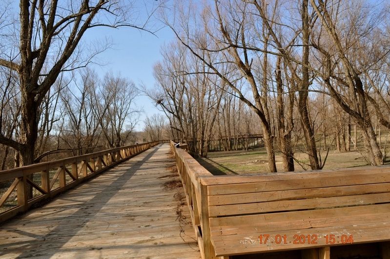 The Delta represents a “melting pot” of diverse cultures. And most of them got here by canoe. Canoeing is the oldest form of water transportation on the Mississippi River-at least 2,000 years old! In the Quapaw tribal . . .


