
(Left side of the marker)
Much of the early history of Thomas Point still lies buried under sand and water at its ever-eroding shoreline. Evidence does exist, however, that Native Americans enjoyed the bounty of the Bay’s seafood sometime between 200 AD and 1500 AD. Large piles of oysters and other shellfish remains, known as middens, still mark the sites of those early harvests and feasts.
The first white man known to settle the area was English merchant Philip Thomas, who owned many acres along what as then the shore of Anne Arundel Bay. Among the land parcels he was granted between 1658 and 1668 was a 165-acre tract called “Fuller Point.” which later became Thomas Point. Thomas died in 1675 and was buried at the “Old Quaker Burial Ground” in Galesville, several miles from here in southern Anne Arundel County. His children later divided the estate.
Ownership of Thomas Point changed several times from then until 1824, when the U.S. government paid $529 for a 7-acre parcel on which to build a lighthouse. Eventually, private interests bought back what remained of the 7-acres in 1914.
In 1917, Mr. and Mrs. Charles F. Lee and Mr. and Mrs. Ridgley P. Melvin sold 72-acres-the present Thomas Point Park and community of Oakwood—to the Thomas Point Duck Club. The club’s original manor house and various out-buildings still stand in Oakwood.
On the small farm that occupied Thomas Point at the time, the only crop known to have been grown was corn, which was probably raised to attract ducks. A small log cabin, which now serves as the park office and the park ranger’s residence, was the hunting lodge for the duck club. This building still stands at Thomas Point, and the names of some prominent members of the duck club can be found carved into the frame of the cabin’s 8-foot fireplace.
The duck club used the hunting lodge for 30 years, before it sold the property to Ferdinand C. and Jane Homer Lee in 1947.
Between 1960 and 1963, the Lees deeded their 44-acres to Anne Arundel County in four parcels at a price of $5.00 each with the stipulation that the property be used for recreation and conservation purpose. Thanks to their generosity, thousands of visitors each year have enjoyed the natural beauty of the park. And thousands more will see this part of the Chesapeake much the way Philip Thomas saw it over 300 years ago.
(Right side of the marker)
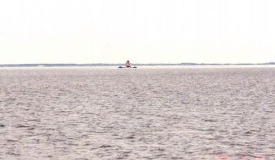
The Thomas Point Lighthouse: A Bay Landmark. One of the most familiar landmarks of the Chesapeake is the Thomas Point Lighthouse. The present lighthouse stands approximately one mile off the end of the point, where it has steered boaters clear of the treacherous Thomas Point shoal since 1874. This structure is actually the third lighthouse to be built in the vicinity. The first began service in 1825 on land that eventually eroded away, at which time it was rebuilt in 1838. The current lighthouse is an unusual white hexagonal building complete with keeper’s quarters. The iron pilings which anchor the lighthouse are literally screwed into the bottom of the Chesapeake Bay.
The Thomas Point lantern generates 6,000 candlepower of white light that is visible for up to 12 miles; boaters can see the 1,300 candlepower red light from approximately 9 miles away. The lighthouse also is equipped with a foghorn that sounds regularly during periods of low visibility.
A keeper manned the lighthouse until the mid-1980 when the light was automated with a generator and batteries.
(Colonial Era • Waterways & Vessels) Includes location, directions, 4 photos, GPS coordinates, map.
 The Chesapeake Bay is one of the largest and one of the most productive estuaries in the world. Fresh water, supplied by over 150 rivers and streams, and salt water from the Atlantic Ocean combine to create the unique conditions and essential nutrients that support over 2,700 plants and animals. A diversity of natural habitants, including underwater grass beds, salt marshes, forested wetlands and upland forests, are all represented. The Bay watershed drainage area encompasses 64,000 square miles of land, from Cooperstown, New York to Cape Charles Virginia. More than 13.6 million people live within this watershed area and their activities affect life in the Chesapeake every day.
 A number of grist and saw mills operated on this site from the late 1700s to the mid 1930s. Due to seasonal changes in the water level, Little Bennett Creek proved unreliable as a constant source of power to turn the water wheel. Milling efficiency improved with the installation of steam powered roller machinery around 1905. Following a devastating fire in 1918, the Hyattstown community assisted in the reconstruction, using materials from nearby Prices Distillery. As technology and marketing changed, many country mills like Hyattstown Mill closed. The mill became part of Little Bennett Regional Park in 1965.
 Signer of the Declaration of Independence
 The stone walls visible here are parts of Lock 107 on the Chenango Canal, which opened in 1837. Constructed as a composite lock of stone lined with wooden planks, Lock 107 was repaired and rebuilt several times over the years. The last rebuild of the lock in the early 1870s replaced the plank lining with vertical oak fenders spaced every four feet anchored in the masonry walls. The pockets in which these oak fenders were set are still visible in the stonework today.
 Founded in 1860, Mack & Company grew to be Ann Arbor’s largest department store. In 1870 it advertised dress goods, household goods, flannels, shawls and cloakings, “selling everything cheap.” By 1900 it had become Main Street’s premier shopping destination, wooing customers with promises of first class service. In the 1920s shoppers could visit Mack’s post office, bank, beauty shop, and pharmacy, enjoy an occasional fashion show or sing along while a pianist played sheet music for sale.Christmas at Mack’s meant elaborate store window displays, a huge decorated tree on a revolving musical stand and the largest toy selection in town. Overwhelmed by the 1930s Depression, Mack closed with its final sale in 1939.
 Westminster "Massacre" Northward stood the Cumberland County Courthouse, seat of New York's colonial administration. Opposition to holding a court session led to the "Massacre" of March 13, 1775. Here the New Hampshire Grants on Jan. 16, 1777, declared their independence as "New Connecticut", later Vermont.
 Annie Jump Cannon (1863-1941), a prominent astronomer who pioneered stellar classification, observed her first stars from the roof of this house. Cannon, who was legally deaf, graduated valedictorian from Wilmington Conference Academy, now Wesley College, in 1880. She continued her studies at Wellesley College and Radcliffe Women's College at Harvard. While working at the Harvard Observatory, Cannon developed the Star Spectra system, classifying over 300,000 stars based on color and temperature. She was the first woman to receive an honorary doctorate from Oxford University and her long career paved the way for women in science.
 In 1680, a large tract of land called "Brothers Portion" was warranted to John and Richard Walker. In 1695, 200 acres of the parcel were purchased to create the town of Dover. When the town plot was completed in 1718, John Mifflin purchased 69 acres of undeveloped land from the town. The property passed througjh the hands of several landowners before being purchased by Nicholas Ridgely in 1748. By 1749, Ridgely had erected a house on the farm. Among his public interest, Nicholas Ridgely served as treasurer of Kent County and as a justice of the provincial Supreme Court of the Three Lower
Counties upon Delaware. After Ridgely's death in 1755, his third wife, Mary had named 'Eden Hill.' She planted two avenues of trees approaching the house. From the 18th through 21st centuries, successive generations of Ridgelys worked hard to keep Eden Hill a productive farm and family home. Eden Hill was purchased by the State of Delaware in 2004 for preservation and use as judicial chambers of the Supreme Court of Delaware.
In 1680, a large tract of land called "Brothers Portion" was warranted to John and Richard Walker. In 1695, 200 acres of the parcel were purchased to create the town of Dover. When the town plot was completed in 1718, John Mifflin purchased 69 acres of undeveloped land from the town. The property passed througjh the hands of several landowners before being purchased by Nicholas Ridgely in 1748. By 1749, Ridgely had erected a house on the farm. Among his public interest, Nicholas Ridgely served as treasurer of Kent County and as a justice of the provincial Supreme Court of the Three Lower
Counties upon Delaware. After Ridgely's death in 1755, his third wife, Mary had named 'Eden Hill.' She planted two avenues of trees approaching the house. From the 18th through 21st centuries, successive generations of Ridgelys worked hard to keep Eden Hill a productive farm and family home. Eden Hill was purchased by the State of Delaware in 2004 for preservation and use as judicial chambers of the Supreme Court of Delaware. State Consolidated District No. 1 was authorized and created on July 1, 1915. Seven months later on February 28, 1916, voters of the district approved the request of the State Board of Education by a vote of 52 to 1 to bond together schools in the towns of Camden and Wyoming, creating Delaware's first-ever consolidated school district. Not long after, the school board adopted the name of Caesar Rodney for the district in honor of the Revolutionary War hero and statesman. More than 100 years later, the Caesar Rodney School District continues to provide educational opportunities for every student.
 Has been designated a
 In 1936, the Valera, Bowen, White Chapel and New Central communities established a common high school. The new centralized campus – the second rural high school in Coleman County – was named to commemorate Texas’ centennial of independence celebrated that year. After the original frame school burned in 1940, Federal grants from the Works Progress Administration helped build a new schoolhouse, gymnasium and teacherage. Consolidation created the Talpa-Centennial District in 1958 and then Panther Creek in 1986, with this campus serving as an elementary school. After a new Panther Creek school opened near Voss in 1988, this site became a cooperative alternative school and later a recreational lodge.

 On September 2, 1906, Privates John F. Henry and Francis A. Zehringer were killed in the line of duty as they attempted to arrest fugitive murderers barricaded in a nearby house. Three other troopers were wounded. Their sacrifice symbolizes the Pa. State Police Call of Honor, which states, in part, "I must serve honestly, faithfully, and if need be, lay down my life as others have done before me, rather than swerve from the path of duty."
 Shepherd fought in the Spanish-American War at El Caney, Cuba with Company D, 7th U.S. Infantry. He was awarded the Medal of Honor on July 1, 1898. Superior officers repeatedly cited him for bravery above and beyond the call of duty. Born in Bullsburg (Cherry Tree), September 28, 1871, he attended the Pine Grove School across the street. He was born and raised a short distance just up Sylvis Road. After the war he moved to California and started his own business and was very successful. He died there April 24, 1942. He served his generation in his time because of his love for his Lord and Savior Jesus Christ.


